Debris Tracker Data

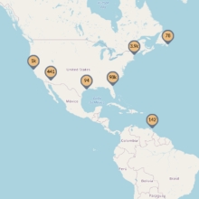
Debris Tracker is designed to help citizen scientists like you make a difference by contributing data on plastic pollution in your community. We've been tracking litter since before smartphones existed, and we're still driven by uniting technology and citizen science to fight plastic pollution. Every day, dedicated educational, non-profit, and scientific organizations and passionate citizen scientists from all around the world record data on inland and marine debris with our easy-to-use app, contributing to our open data platform and scientific research.

Deadline Set For Residents Of Vanishing Isle De Jean Charles To Apply For Relocation

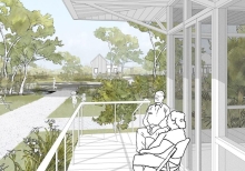
Residents of a sinking Louisiana island have until the end of the month to apply for a new home under a first-of-its-kind federal program to help people retreat from the effects of climate change. The state Office of Community Development set Jan. 31 as the deadline for Isle de Jean Charles residents to request resettlement in a new housing development near Houma or an existing home elsewhere in Louisiana.

Cyanobacteria Assessment Network (Cyan)

CyAN is a multi-agency project among EPA, the National Aeronautics and Space Administration (NASA), the National Oceanic and Atmospheric Administration (NOAA), and the United States Geological Survey (USGS) to develop an early warning indicator system to detect algal blooms in U.S. freshwater systems. This research supports federal, state, tribal, and local partners in their monitoring efforts to assess water quality to protect aquatic and human health.

Critical Habitat, Coastal Land Loss, And Land Loss/ Land Change Analysis Of The Lake Pontchartrain Basin, Louisiana

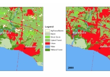
Wetlands in the Lake Pontchartrain Basin have declined dramatically since 1982 due to a variety of causes such as urbanization and coastal erosion. Although natural processes have contributed to some of this loss, much of it can be attributed to human activities. Some of the wetland losses can be directly traced to dredging or filling of these areas... The Florida Parishes, which include East Baton Rouge, East Feliciana, Livingston, St. Tammany, Tangipahoa, and Washington Parish, have experienced an accelerated population growth during the past 18 years.

Critical Gaps In Seagrass Protection Reveal The Needs To Address Multiple Pressures And Cumulative Impacts

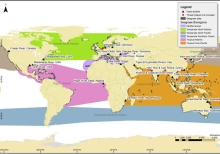
Management is failing to adequately protect coastal ecosystems. Here we reviewed the policies, legislation, plans and management frameworks intended to protect seagrass meadows in 20 case-studies with the aim of identifying critical gaps in seagrass protection. The case-studies were chosen to represent a range of regions known to have high cumulative impacts or outstanding seagrass management

Considering Flood Risk

Turning the Tide' and this companion educational guide encourage students to think about what is at stake in terms of crucial wetland ecosystems, Gulf seafood populations, North American migratory bird and waterfowl populations, the nation's energy infrastructure and national security, interior navigation and water transport for American produce and goods, and a totally unique American culture.

Compensating For Wetland Lossess Under The Clean Water Act: Outcomes Of Wetlands Restoration And Creation

Underlying wetland mitigation is the assumption that it is scientifically possible for humans to recreate the structure and functions of a wetland, either by restoring a site that had previously been a wetland or by creating an entirely new wetland. The purpose of this chapter is to discuss the ecological principles of wetland creation and restoration science and evaluate the current scientific ability of practitioners to restore or create various aspects of wetland functioning in a variety of environments.

Combating Coastal Land Loss

Coastal residents are not strangers to environmental issues that threaten our land and lives. But how can we address them? In this TEDx talk, wetland ecologist Karen McKee explains some of the science behind land subsidence, the importance of coastal ecosystems, what this means for the future of communities, and discusses potential tools to move toward solutions.

Coastwide Reference Monitoring System

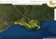
The Coastwide Reference Monitoring System (CRMS) was designed to monitor the effectiveness of restoration actions at multiple spatial scales from individual projects to the influence of projects on the entire coastal landscape. The CRMS design includes a suite of sites encompassing a range of ecological conditions in swamp habitats and fresh, intermediate, brackish, and salt marshes. The CRMS reference network approach allows for comparisons of changing conditions at CRMS sites within and outside of restoration and protection projects."