Wetlands Mapper

The Wetlands mapper is designed to deliver easy-to-use, map like views of America's Wetland resources. It integrates digital map data along with other resource information to produce current information on the status, extent, characteristics and functions of wetlands, riparian, and deepwater habitats. The Wetland Mapper fulfills the U.S. Fish and Wildlife Service's strategic plan for the development, revision and dissemination of wetlands data and information to resource managers and the public.

Wetland Restoration Landowner Benefits

Voluntary public?private partnerships through conservation easements are important programs for conserving and restoring wetlands in the Great Lakes watershed. Little is known about what motivates landowners to participate, landowners' perceived value of the projects, the conservation management practices they undertake, and the impact of wetland restoration on property values. Therefore, the team evaluated wetland restoration projects based on biodiversity and environmental quality; hydrology and hydraulics; property owner knowledge, attitudes and behaviors; and impact on property value.

Wetland Restoration

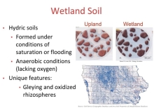
Wetlands are among the richest and most diverse places on earth. Thousands of fish, mammals and birds call the wetlands home. If you can believe it, wetlands, thick with plants and soggy soils, act as a sponge, soaking up pollutants to help keep our water clean. They also help protect people from floods and storms.

We Are All Vulnerable To The Effects Of Water Pollution

Dr. Jamie Dewitt explains her research in Phamacology and Toxicology and why water pollution might pose a problem no matter where you are... Her current scientific research focus is on how exposure to emerging contaminants in the aquatic environment, such as per- and poly-fluoroalkyl substances (PFASs) and pharmaceutical and personal care products, affect the adult and developing immune and nervous systems.

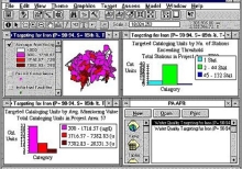
Watershed Modeling

This module has three main purposes. It should help you to: (1) Understand when and how modeling can contribute to watershed assessment. (2) Learn approaches and tools that are useful for watershed modeling. Note that the requirements of watershed assessment can necessitate different tools and approaches from a traditional point source modeling problem. (3) Understand the considerations in choosing models for watershed assessments.

Water Ways: How The Dutch Are Building Coastal Protection For Less- With Nature's Help

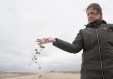
The Sand Motor is a nature-based alternative to the Netherlands' famed network of walls, levees and sea gates, and much cheaper than the vast, multimillion-dollar beach rebuilds Louisiana is undertaking along its sandy barrier islands and rapidly deteriorating coastline. Where Louisiana's projects seek to re-create almost precisely what was lost, the Dutch simply pile the sand in a strategic location where it will be pushed naturally into places where it will still provide protection.

Water Topics

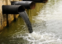
When the water in our rivers, lakes, and oceans becomes polluted; it can endanger wildlife, make our drinking water unsafe, and threaten the waters where we swim and fish. EPA research supports efforts under the Clean Water Act and Safe Drinking Water Act.