C-Cap Land Cover Atlas

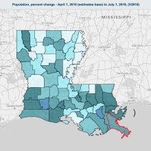
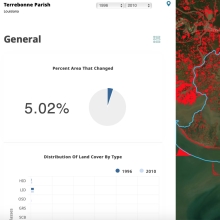
This online data viewer provides user-friendly access to coastal land cover and land cover change information developed through NOAA's Coastal Change Analysis Program (C-CAP). The tool summarizes general change trends (such as forest losses or new development) and provides tables, maps, and reports to enhance communication and decision-making.

Building On The Shore

In this episode, we're learning about coastal erosion and how it affects homes built near the shore. We explore the coastline with Hawai'i Sea Grant Extension Agent, Ruby Pap, and County of Kauai planner, Ka'aina Hull, to see what happens when buildings are put too close to the ocean compared to buildings that are set-back, allowing natural beach action and sea-level rise to occur - without damaging properties.

As Sea Level Rise Threatens Their Ancestral Village, A Louisiana Tribe Fights To Stay Put

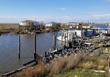
Ten years ago, as news of the BP oil disaster reached Louisiana's Grand Bayou Indian Village, Rosina Philippe dispatched her brother Maurice Phillips on a reconnaissance mission. Phillips pointed his flatboat toward the Gulf of Mexico and motored through a series of canals and inlets until he reached a fertile fishing ground called Bay Jimmy, eight miles from home. He returned with a passenger: a brown pelican, alive but slathered in petroleum. Philippe and her brother belong to the Atakapa-Ishak/Chawasha Tribe.

An Overview Of Coastal Land Loss: With Emphasis On The Southeastern United States

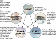
This report represents a general overview of the primary causes and consequences of coastal land loss. Most of the examples and references are from states bordering the Gulf of Mexico and the Atlantic Ocean where the largest magnitudes and highest rates of coastal land losses in the United States are recorded (Dahl, 2000). The report serves as an introductory guide to the topics and literature on coastal land loss, and acts as a link to ongoing research being conducted by the U.S. Geological Survey.

An Introduction To Living Shorelines

Living shorelines' is a term used to define a number of shoreline protection options that allow for natural coastal processes to remain through the strategic placement of plants, stone, sand fill, and other structural and organic materials.The goal is to retain much of the wind, tide, and storm-related wave protection of a hard structure, while maintaining some of the features of natural shorelines.

Aerial Seeding

In addition to restoration by volunteers, PC also utilizes aerial seeding techinques. If successful the seeds spread by airplane will grow into towering swamp trees, which will help to rebuild swamp habitat and will also protect surrounding communities from storm surge.