The Arctic Oceans As A Dead End For Floating Plastics In The North Atlantic Branch Of The Thermohaline Circulation

The subtropical ocean gyres are recognized as great marine accumulation zones of floating plastic debris; however, the possibility of plastic accumulation at polar latitudes has been overlooked because of the lack of nearby pollution sources. In the present study, the Arctic Ocean was extensively sampled for floating plastic debris from the Tara Oceans circumpolar expedition.

Surviving And Thriving In The Face Of Rising Seas

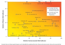
The growing consequences of climate change threaten communities up and down the U.S. coast. But some communities are particularly vulnerable due to a combination of climate and socioeconomic risks... Fairness, justice, and equity go to the heart of what a true democracy like ours stands for. As a nation, we need to bring those principals to bear as we work together to confront the consequences of climate change.

Stormwater To Stree Trees: Engineering Urban Forests For Stormwater Management

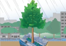
Installing trees in locations that are engineered to retain stormwater is a great way to augment existing stormwater management systems, increasing their capacity and improving water quality while greatly improving the urban forest canopy. This guide is an introduction to those engineered systems available, and in use today, that utilize trees to manage a volume of stormwater. These systems, in addition to providing a solution for managing runoff, also grow big trees.

Statewide Summary For Louisiana

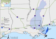
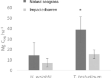
Although wigeon grass (Ruppia maritima) is common all along coastal Louisiana, true seagrass meadows containing turtle grass (Thalassia testudinum), manatee grass (Syringodium filiforme), shoal grass (Halodule wrightii), and star grass (Halophila englemannii) currently occur only east of the Mississippi River near the Chandeleur Islands (fig. 1).

St. Tammany Shoul Dlook At Focuses Development, Not Suburban Sprawl, To Avoid Becoming ' Anywhere, Usa' Experts Say

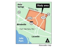
St. Tammany Parish has a choice in how it confronts inevitable growth: It can allow continued suburban sprawl, eating up more and more of the rural land that attracted many residents to the parish, or it can create centers where people can live, work and play in a relatively small area, a panel of experts from the Urban Land Institute said at a public meeting. The panelists called the latter approach the 'village in the woods' pattern - one that could create the equivalent of 25 Covington-like centers - and urged parish leaders to embrace it.

St. Tammany Parish Just Keeps Growing. See The Data

St. Tammany Parish has roughly 22,500 more people living there than it did eight years ago. And people continue to move into the parish. That latest U.S. Census Bureau estimates show St. Tammany's population was up 1.4 percent in July 2017 compared with the year prior. Last year was the seventh consecutive year of population growth for the parish. Much of that growth is thanks to new residents who continue to move into St. Tammany at a healthy clip.

Sri Lanka: Learning From Failure-Mixed Results Of Post- Tsunami Mangrove Restoration

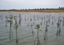
In 2004, the devastating Indian Ocean tsunami invigorated the Sri Lankan government and people to turn their attention to restoring the country's mangrove stands to prevent such catastrophic damage from future disasters. It has an area of approximately square 65,610km with a coastline of about 1,620km on the Indian Ocean. Mangrove restoration projects were launched in Sri Lanka covering over 2,000 hectares. However, over 80% of these projects failed. Kondikara et al. 2017 conducted an assessment of the success of 23 mangrove restoration projects implemented following the 2004 tsunami.

Slip-Sliding Away? The Challenge Of Implementing St. Tammany's Vision For Growth Management

St. Tammany Parish has spent decades engaged in the business of poorly guided development. The results: willy-nilly growth patterns, environmental degradation, traffic congestion, and a declining quality of life. Concerned with the consequences of inadequately controlled growth, the Parish is currently engaged in the New Directions 2025 comprehensive planning process. The process began with a vision to bring growth under control and preserve quality of life. But as time passes, that vision continues to disintegrate before citizens' very eyes.

Signs Of Katrina Linger In The Marshes

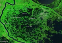
The wetlands surrounding Delacroix, a fishing town to the southeast of New Orleans, were some of the hardest hit by the hurricane. Pounding surf, driving winds, and a potent storm surge transformed the marshes by picking apart mats of dead grass, stirring up and disbursing soft underlying sediments, scouring several new channels, and depositing leftover sediment and debris in new areas. This pair of false-color images shows the transformation. The Thematic Mapper on Landsat 5 acquired the top image a week before the storm hit.