Resource Category
Resource Subject
Resource Content Type
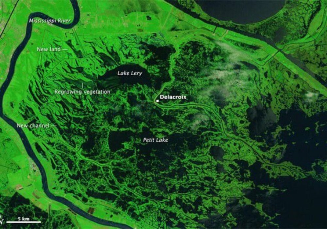
The wetlands surrounding Delacroix, a fishing town to the southeast of New Orleans, were some of the hardest hit by the hurricane. Pounding surf, driving winds, and a potent storm surge transformed the marshes by picking apart mats of dead grass, stirring up and disbursing soft underlying sediments, scouring several new channels, and depositing leftover sediment and debris in new areas. This pair of false-color images shows the transformation. The Thematic Mapper on Landsat 5 acquired the top image a week before the storm hit. The Operational Land Imager (OLI) on Landsat 8 acquired the second image in August 2015.