Filter These Results +
Living Shorelines
Living shorelines' is a term used to define a number of shoreline protection options that allow for natural coastal processes to remain through the strategic placement of plants, stone, sand fill, and other structural and organic materials. Living shorelines often rely on native plants, sometimes supplemented with stone sills, on-shore or off-shore breakwaters, groins, or biologs to reduce wave energy, trap sediment, and filter runoff, while maintaining (or increasing) beach or wetland habitat (National Research Council, 2007).
Lobsterville Beachgrass Restoration
Lobsterville Beach Grass Restoration - The Natural Resource Department of the Wampanoag Tribe of Aquinnah successfully restores an area of beach using beach grass.
Long-Term Performance In Seagrass Restoration Projects In Florida, Usa
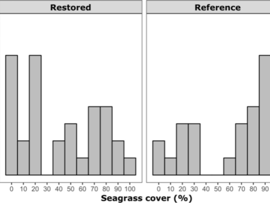
Seagrass restoration is a common tool for ecosystem service enhancement and compensatory mitigation for habitat loss. However, little is known about the long-term performance of these projects. We identified seagrass restoration projects by reviewing historic permitting documents, monitoring reports, and studies conducted in Florida, USA, most of which have not been cited previously in peer-reviewed literature. We then revisited 33 seagrass restorations ranging in age from 3 to 32 years to compare seagrass percent cover, species diversity, and community structure in restored and contemporary reference seagrass beds.
Losing Ground
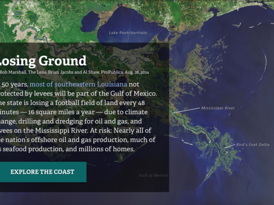
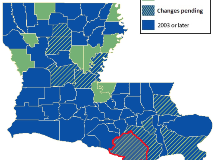
In 50 years, most of southeastern Louisiana not protected by levees will be part of the Gulf of Mexico. The state is losing a football field of land every 48 minutes -- 16 square miles a year -- due to climate change, drilling and dredging for oil and gas, and levees on the Mississippi River. At risk: Nearly all of the nation's offshore oil and gas production, much of its seafood production, and millions of homes.
Louisiana Coastal Resilience Game
What does the future hold for culture, industry, and ecology along the coast of Louisiana? What can be done about it? The Louisiana Coastal Resilience Game allows participants to implement protective and restorative efforts of varying cost and estimated degrees of impact along Louisiana's coastline and observe potential future outcomes under different policy and weather scenarios.
Louisiana Conservation Servitudes
A conservation servitude, known as a conservation easement in other states, is a voluntary deeded restriction on your property that prevents it from being developed in certain ways. However, it does not mean that you relinquish ownership of the property. You can still sell, mortgage, and pass the land to your children. Conservation servitudes are flexible in that you can pick restrictions and requirements that fit your conservation vision. For example, you can restrict development of homes and roads on the property or subdivision of the land, but if you wish you can continue sustainable farming, ranching, or logging operations that are consistent with the conservation purpose of the servitude.
Louisiana Floodmaps Portal
The FloodMaps Portal "presents Flood Insurance Rate Maps (FIRMs) and related products. It also shows ground elevations provided by the USGS."
Louisiana Waterways Among Most Polluted In Nation, Report Says
A 10-year-old girl walks to the edge of the Kansas River in Topeka, Kansas, rolls up a note, and slips it into a plastic bottle before sending it downstream. Sixteen years, hundreds of miles, and two rivers later, Michael Coyne-Logan, an educational facilitator for Living Lands and Waters, hoists it from the Mississippi River in St. Louis. That is one bottle among the millions of pounds of trash that he and his cleanup crew have collected in recent years as they try to make a dent in the enormous amount of garbage floating down the Mississippi.
Louisiana's Disappering Coast
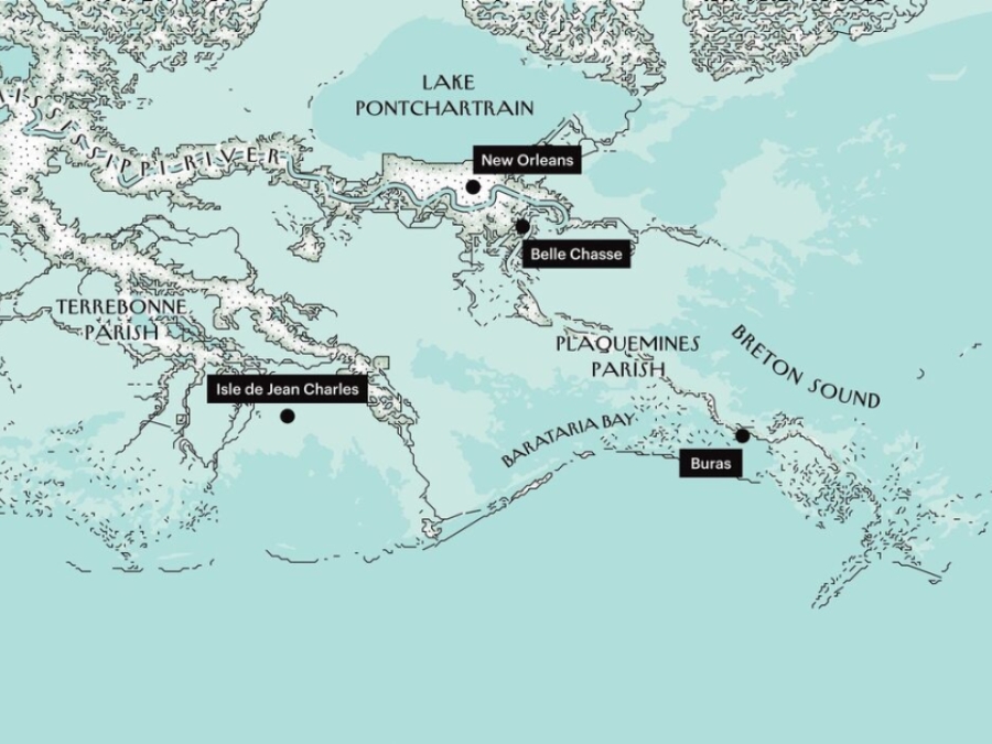
Plaquemines is where the river meets the sea. On maps, it appears as a thick, muscular arm stretching into the Gulf of Mexico, with the Mississippi running, like a ropy blue vein, down the center. At the very end of the arm, the main channel divides into three, an arrangement that calls to mind fingers or claws, hence the area's name - the Bird's Foot. Seen from the air, the parish has a very different look. If it's an arm, it's a horribly emaciated one. For most of its length - more than sixty miles - it's practically all vein. What little solid land there is clings to the river in two skinny strips. Plaquemines has the distinction - a dubious one, at best - of being among the fastest-disappearing places on Earth.
Louisiana's Vanishing Coast: Before And After Images Show A Decade's Loss
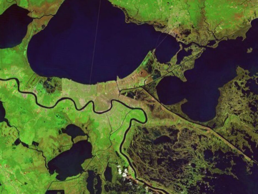
The scars of coastal loss, accelerated by Hurricane Katrina in 2005, still can be seen on the wetlands surrounding New Orleans, visible in before and after images taken by combined camera and sensor devices aboard NOAA Landsat satellites. Wetlands surrounding Delacroix are shown a week before Katrina, with normal vegetation showing up as bright green and water as blue. The Caernarvon Freshwater Diversion Project releases water from the Mississippi River into the Big Mar, and it eventually flows southeast through these wetlands.
Macroinvertebrates & Water Quality
Studying macroinvertebrates is one indicator used by scientists to determine water quality in stormwater ponds and natural waterways. Educators and others who work with students can use this hands-on exercise to expand learning outside the classroom by following the simple steps outlined in this video.
Mainstreaming Climate Action Into Sustainable Development
This webinar, the first of a series of three dedicated to the Partnership in Action report, will see how countries are integrating climate action into domestic policy, planning, budget, and SDG agendas across government in the COVID-19 era, including using climate action as a basis for economic recovery and involving many varied actions. It will offer snapshots on how countries are facing up to COVID, health issues, inclusive growth, and adaptation, as well as their efforts to engage youth and make climate action gender responsive.
Managing The Retreat From Rising Seas
This report is composed of 17 individual case studies. Each one tells a different story about how states, local governments, and communities across the country are approaching questions about managed retreat. Together, the case studies highlight how different types of legal and policy tools are being considered and implemented across a range of jurisdictions - from urban, suburban, and rural to riverine and coastal - to help support new and ongoing discussions on the subject. These case studies are intended to provide transferable lessons and potential management practices for coastal state and local policymakers evaluating managed retreat as one part of a strategy to adapt to climate change on the coast.
Marine Debris
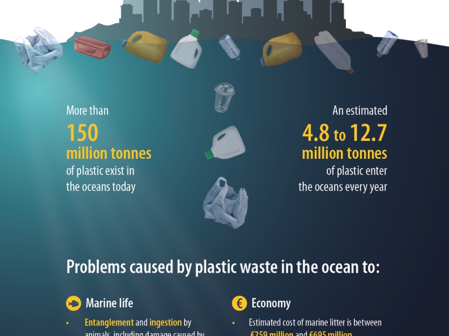
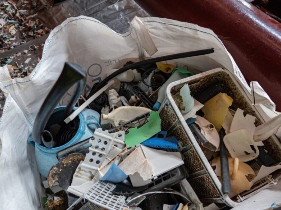
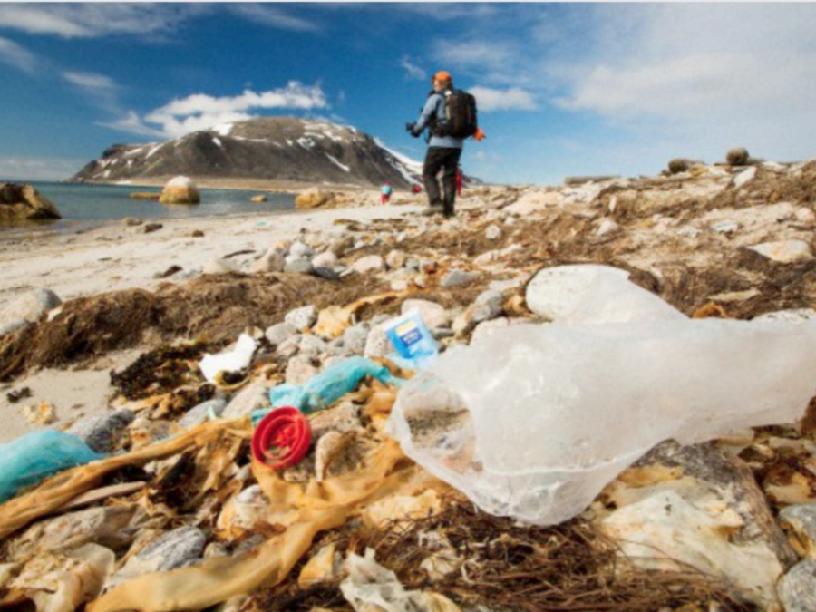
Marine debris is litter that ends up in oceans, seas, or other large bodies of water. This manmade debris gets into the water in many ways. People often leave trash on beaches or throw it into the water from boats or offshore facilities, such as oil rigs. Sometimes, litter makes its way into the ocean from land. This debris is carried by storm drains, canals, or rivers. The wind can even blow trash from landfills and other areas into the water. Storms and accidents at sea can cause ships to sink or to lose cargo.
Marine Debris, Fishing For Microplastics In Your Home
There has been a growing of public awareness of plastics found in the ocean environment. Plastics are found at the top and within the water column, in ocean floor sediments, and within beach material. This activity will demonstrate the ease of movement of plastics from your home directly into the ocean environment. Students will explore the typical products which contain plastics and learn how to calculate the concentration of plastics found in a chosen personal care product.
Marine Debris: Fishing For Microplastics In Your Home
There has been a growing of public awareness of plastics found in the ocean environment. Plastics are found at the top and within the water column, in ocean floor sediments, and within beach material. This activity will demonstrate the ease of movement of plastics from your home directly into the ocean environment. Students will explore the typical products which contain plastics and learn how to calculate the concentration of plastics found in a chosen personal care product.
Marine Litter Plastic And Microplastics And Their Toxic Chemicals Components: The Need For Urgent Preventive Measures
Persistent plastics, with an estimated lifetime for degradation of hundreds of years in marine conditions, can break up into micro- and nanoplastics over shorter timescales, thus facilitating their uptake by marine biota throughout the food chain. These polymers may contain chemical additives and contaminants, including some known endocrine disruptors that may be harmful at extremely low concentrations for marine biota, thus posing potential risks to marine ecosystems, biodiversity and food availability.
Marine Pollution Statistics & Fact
Marine life, as we know it, is suffering irreparable damage from the chemical pollution of the waters and the millions of tons of mismanaged waste dumped in the oceans each year. The result is a planetary crisis with over 100 million marine animal's lives get lost every year, and the decay of the ocean's ecosystem.
Master Plan Data Viewer
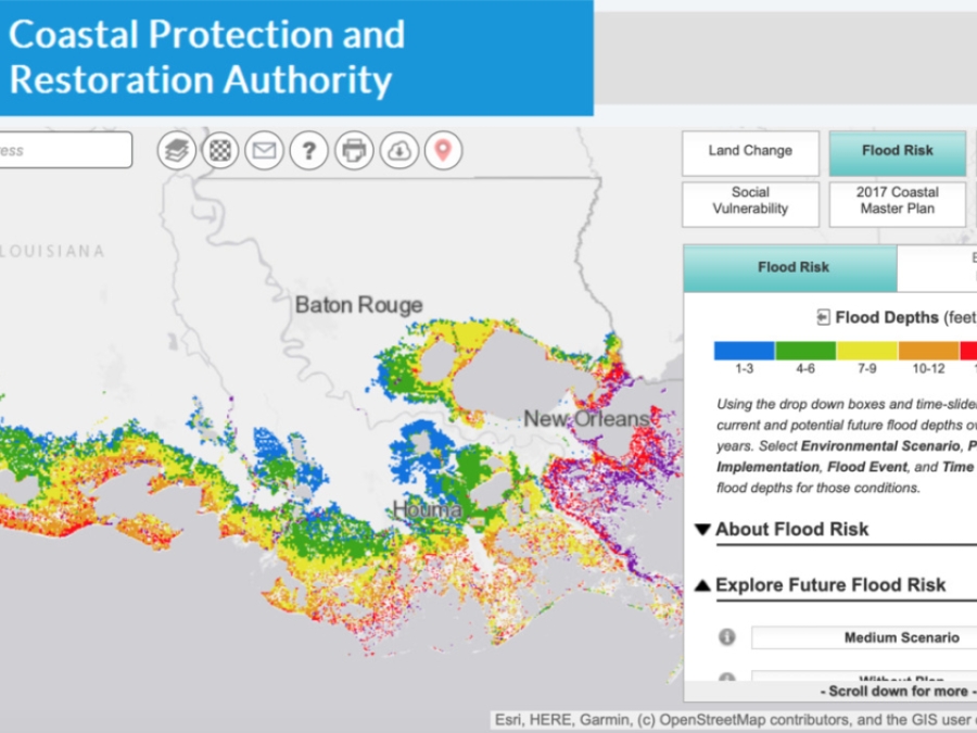
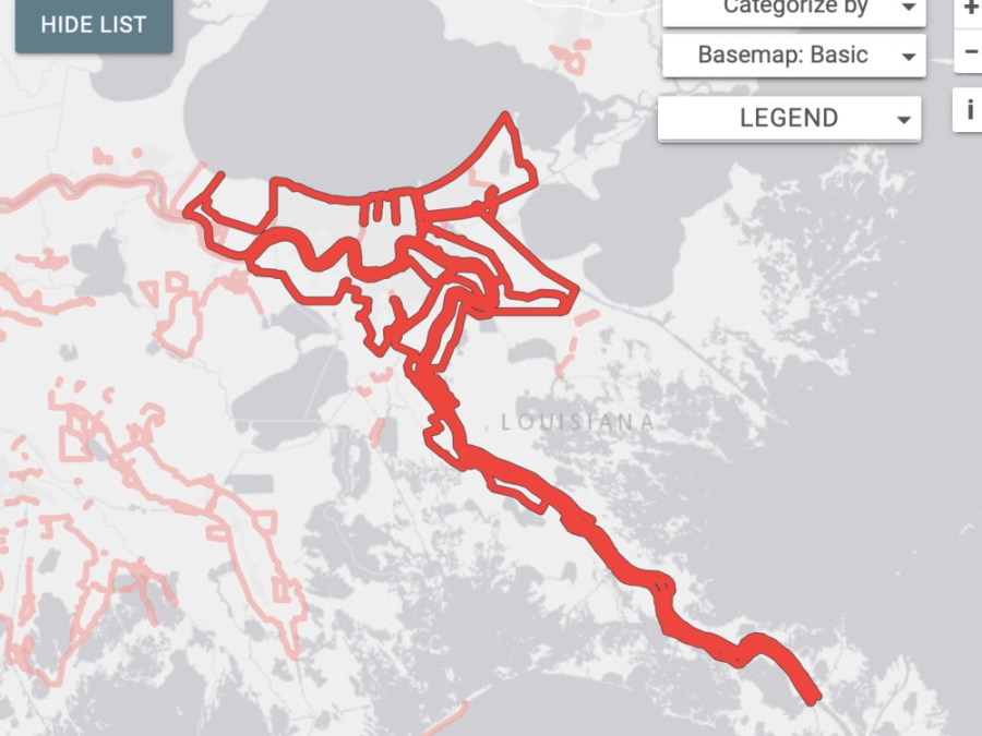
This viewer displays the results from CPRA's 2017 Coastal Master Plan and provides resources to reduce risk. Information includes: future land change, storm surge flood risk, coastal vegetation, and social vulnerability. Also included are the state's proposed restoration, structural protection, and nonstructural risk reduction projects to help make communities safer. This information is for coastal planning purposes, and is not appropriate for site-specific decision making.
Master Pland Data Viewer
This viewer displays the results from CPRA's 2017 Coastal Master Plan and provides resources to reduce risk. Information includes: future land change, storm surge flood risk, coastal vegetation, and social vulnerability. Also included are the state's proposed restoration, structural protection, and nonstructural risk reduction projects to help make communities safer. This information is for coastal planning purposes, and is not appropriate for site-specific decision making.
Megacities Reflect Growing Trend
The capital of the South Asian country Bangladesh, Dhaka, has a population that is booming. However, it stands as one of the world's poorest mega-cities. This report comes from a GlobalPost series about the rise of mega-cities.
Microfibers: The Next Frontier Of Plastic Pollution
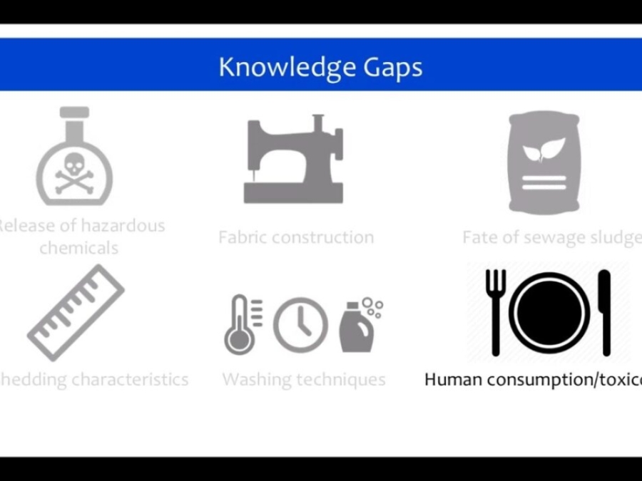
Scientists are still beginning to understand the effects of plastic pollution on marine life who suffer injury and death through entanglement and ingestion of the synthetic material. Now we've discovered that there is a new microscopic form of plastic pollution entering our waterways from the washing of clothing that includes nylon, acrylic, and PET materials.
Microplastic Madness
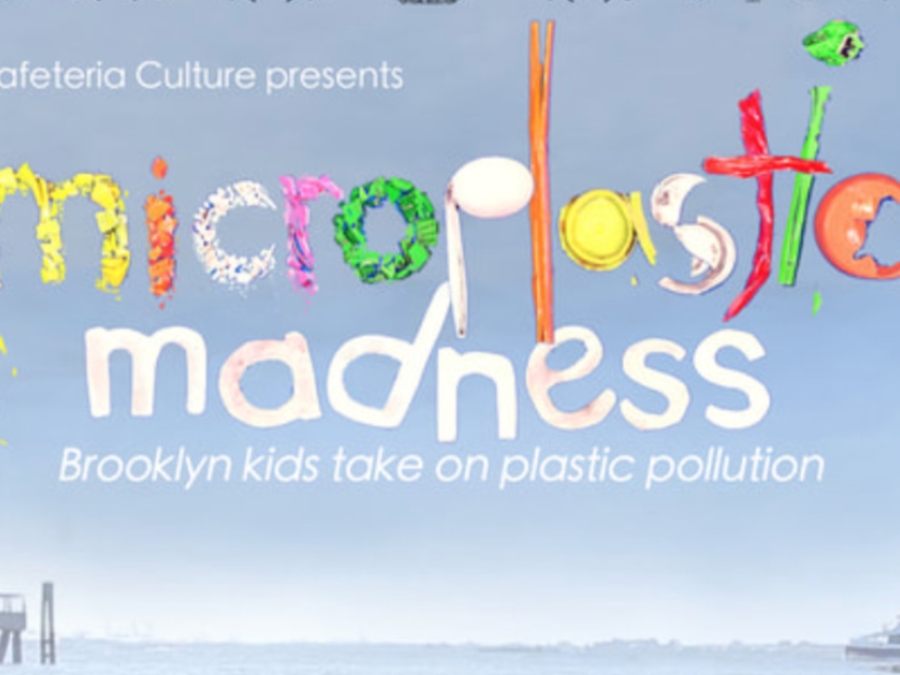
Microplastic Madness is the story of 56 fifth graders from P.S. 15 in Red Hook, Brooklyn - living on the frontline of the climate crisis - whose actions on plastic pollution morph into extraordinary leadership and scalable victories.
Microplastic Sampling Map
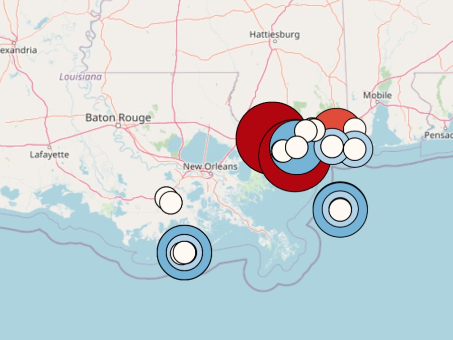
The map below is the result of a U.S. Gulf-wide microplastic sampling project. The Gulf of Mexico Alliance Gulf Star Program provided funding for this citizen science project. Citizen scientists collected and counted microplastics in sediment and water samples across the US Gulf coast. The numbers of microplastics displayed are from 1-liter water samples and 0.25 square meter sediment samples.
Microplastics In Our Nation's Waterways
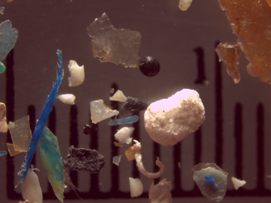
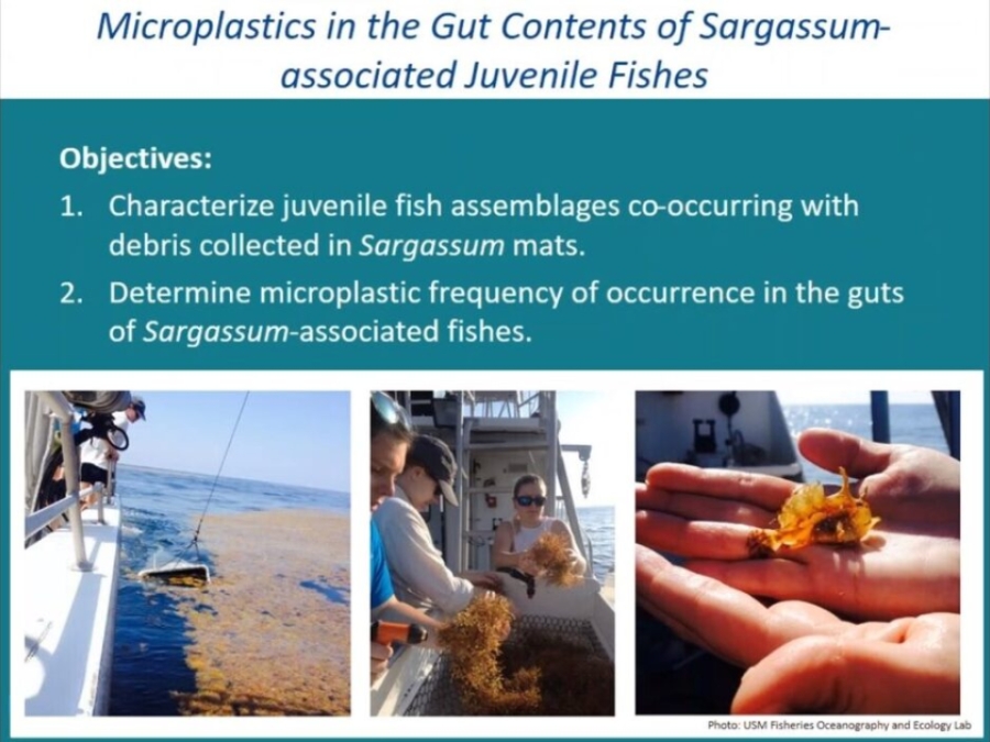
Microplastics are the miniscule plastic fragments (smaller than 0.04 inch) that fall off of decomposing plastic bottles and bags, and are intentionally manufactured into some toothpastes and lotions. Scientists have found microplastics nearly everywhere, particularly in lakes, rivers, and aquatic animals... U.S. Geological Survey and State University of New York Fredonia scientists sampled rivers flowing into the Great Lakes3 to find out which kinds of microplastics are most commonly found in rivers, and which rivers contain the most microplastics particles. These scientists found that rivers carry many different kinds of microplastics, and were surprised to learn that plastic microbeads make up only a small fraction of all microplastics.
Microplastics: An Emerging Threat To Global Ecology And Public Health
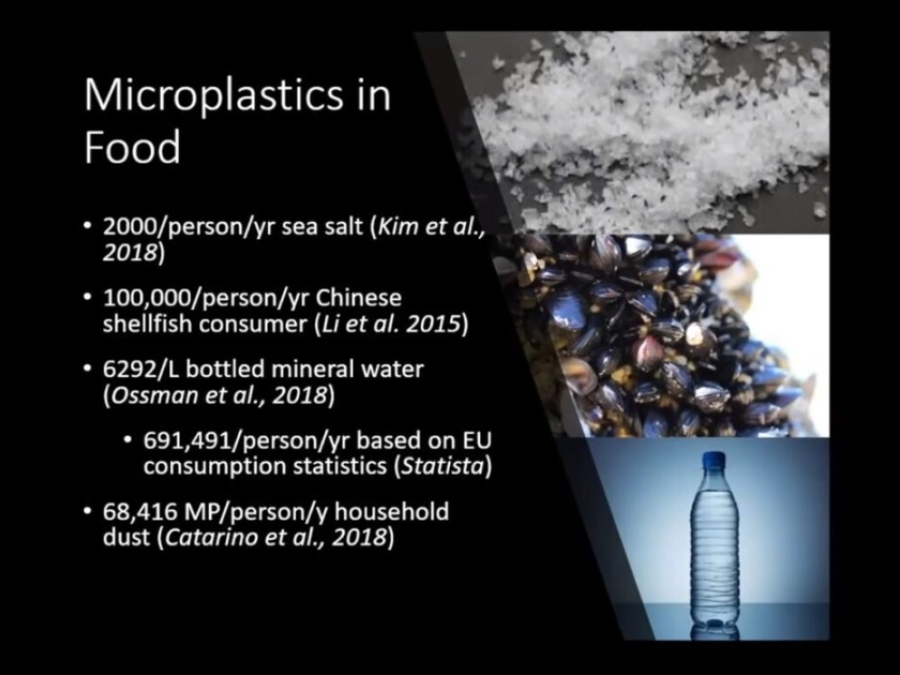
Microplastics, defined as plastic particles smaller than 5mm, are a well-known marine pollutant. An estimated 93,000 to 236,000 metric tons of microplastics litter the world's oceans, according to a 2015 study. Recent evidence suggests that they also contaminate freshwater environments, the food we eat, and even the air we breathe. Yet the consequences for human health are largely unknown.
Microplastics: What We Know And Discussion Of Research Needs
Dive into the world of microplastics with the NOAA Marine Debris Program! Learn about what microplastics are, the different types, the impacts associated with microplastic marine debris, and future research needs.
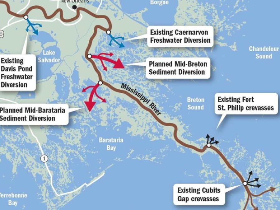
Mid- Barataria Sediment Diversion
Rudy Simoneaux, engineering manager for the Coastal Protection and Restoration Authority explains the concept behind the Mid-Barataria Sediment Diversion Project to be located near Myrtle Grove, Louisiana.
Migration As Adaptation
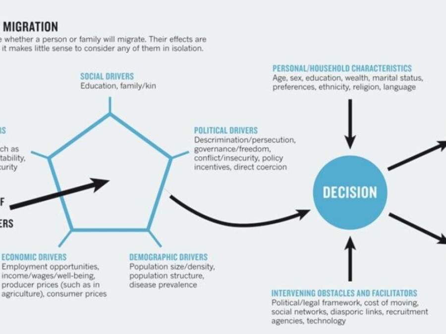
The effects of global environmental change, including coastal flooding, reduced rainfall in drylands and water scarcity, will almost certainly alter patterns of human migration. Conventional narratives usually cast these displacements in a negative light, with many millions of people forced to move, and tension and conflict the result. Our study suggests that the picture is not so one-sided. The study, the UK government's Foresight report on migration and global environmental change, examines the likely movement of people within and between countries over the next 50 years. It contends that, although environmental change will alter an already complex pattern of human mobility, migration will offer opportunities as well as challenges. The greatest risks will be borne by those who are unable or unwilling to relocate, and may be exacerbated by maladaptive policies designed to prevent migration. It is time for a fresh discourse - and fresh research - on migration in relation to global environmental change."
Mircroplastics And Marine Environment
Inspired by the growing public interest for marine micro-plastics and by the lack of specific teaching activities in our country (Italy), we developed a vertically articulated curriculum on micro-plastics for students aged 5-15 years. Our proposal is based on a number of practical activities realized with different language and communication styles to be suitable for different age groups.
Mississippi River Diversions Led To Land Loss, Not Growth, Study Says Implication Are 'Obvious'
Two Mississippi River diversions created to reduce salinity levels in Breton Sound and the Barataria Basin, and a crevasse that cut through the river's east bank levee in Plaquemines Parish, actually caused the loss of more wetlands than they helped build, according to a new study led by LSU researchers. But experts caution that the study does not necessarily portend similar results for the two massive diversions planned along the lower Mississippi in the next few years - diversions designed with the specific goal of land-building.
Mississippi River Nurdle Spill Inspires Effort In Congress To Curb Plastic Pollution
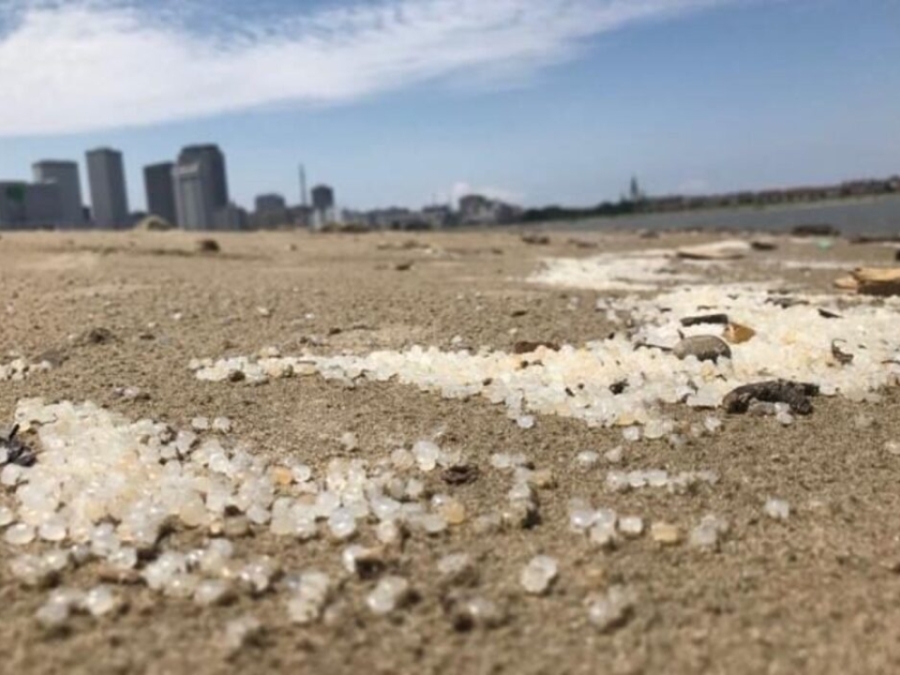
Outrage over last month's sprawling Mississippi River nurdle spill in New Orleans and the lax government response to it has inspired a bill in Congress to prevent similar incidents. Sen. Tom Udall, D-N.M., had already introduced a wide-ranging bill to reduce plastic pollution, and last week he drafted a new one aimed specifically at prohibiting the discharge of plastic pellets, called nurdles, into rivers and oceans.
Model My Watershed
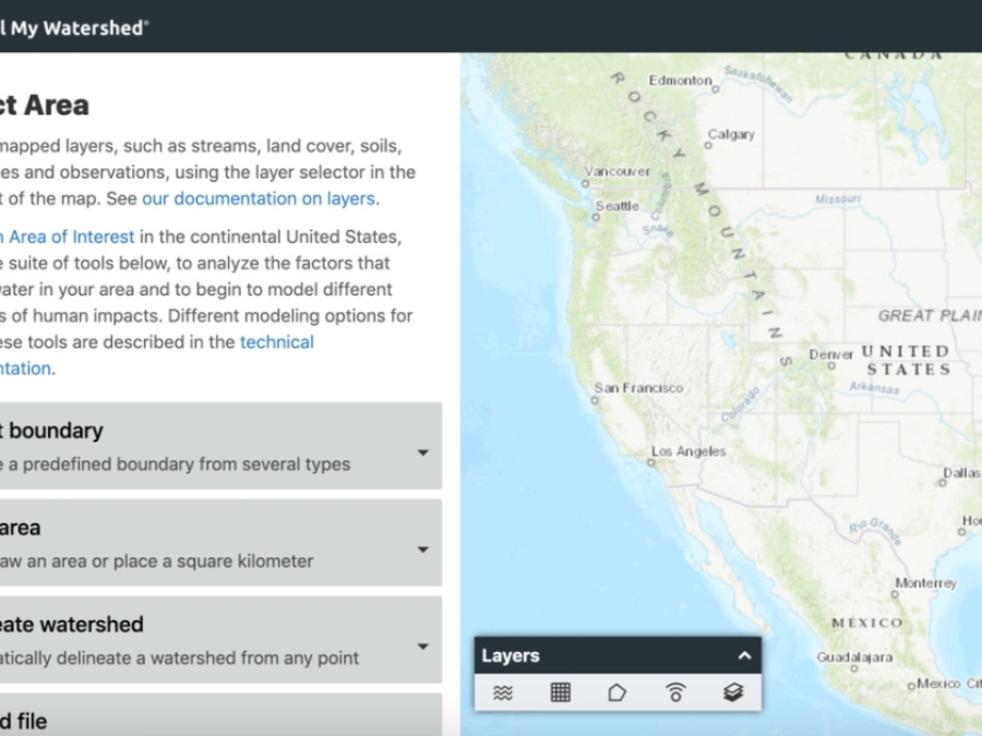
Model My Watershed is a watershed-modeling web app that enables citizens, conservation practitioners, municipal decision-makers, educators, and students to analyze real land use and soil data in their neighborhoods and watersheds, model stormwater runoff and water-quality impacts using professional-grade models, and compare how different conservation or development scenarios could modify runoff and water quality.
Model My Watershed- Runoff Simulation
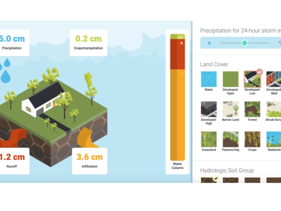
The Runoff Simulation is an animated version of the Site Storm Model package of Model My Watershed. It allows users to learn how land use and soil together determine whether rainfall infiltrates into the soil, runs off into streams or is evaporated and transpired by plants."
Monitoring Estuarine Water Quality
Estuaries are critically important ecosystems, yet they are also some of the most impacted by human activities. In this module, students will use real data to investigate the water quality characteristics of an estuary (water temperature, salinity and oxygen), the relationship between these parameters, and the effect that water quality has on estuarine organisms. Explore the Water Quality activity and download the Teacher's Guide.
Multiple Lines Of Defense Strategy
The coast has always been our first line of defense against hurricanes for southeast Louisiana. Recognizing this, Pontchartrain Conservancy (PC) developed the Multiple Lines of Defense Strategy designed to help save our coast. In the simplest terms, this strategy highlighted below shows how natural features of our coast (like barrier islands, marshes, and ridges) compliment man-made features (like levees) to protect the Greater New Orleans area from hurricanes.
Multitemporal Imagery Based Analysis Of Urban Land In St. Tammany Parish In Conjunction With Socioeconomic Data
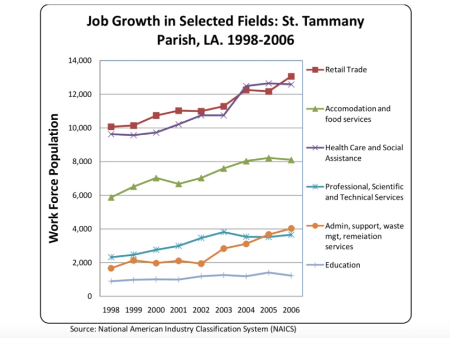
Urbanization would appear on the surface a natural course of creation by humans. Cities grow with populations; the idea seems clear yet there is more than just a growth in population that lies behind each unique city expansion. St. Tammany Parish, a suburb parish of New Orleans, Louisiana, that has its own distinct history like many other counties in the United States... Early growth in St. Tammany Parish was slow; however, through a multitude of factors, it has become the fastest growing parish in the state and has the capability to become the most populous parish in the state if it maintains current growth patterns. This makes it an ideal choice for study using digital technology and census data. Both approaches have been masterfully approached by a variety of scientists and researchers to treat an abundance of issues and problems.
My Louisiana Love
Tracing Monique Verdin's quest to find a place in her Native American community as it suffers from decades of environmental degradation. When she returns to Louisiana to reunite with family, she sees that the traditional way of life is threatened by a cycle of man-made environmental crises. Monique must overcome the loss of her house, her father and her partner, and redefine the meaning of home."
Nasa's Earth Minute: Sea Level Rise
For over 20 years NASA has been tracking the global surface topography of the ocean in order to understand the important role it plays in our daily lives. Climate change is causing our ocean to warm and glaciers to melt, resulting in sea level rise.
National Beach Nourishment Database
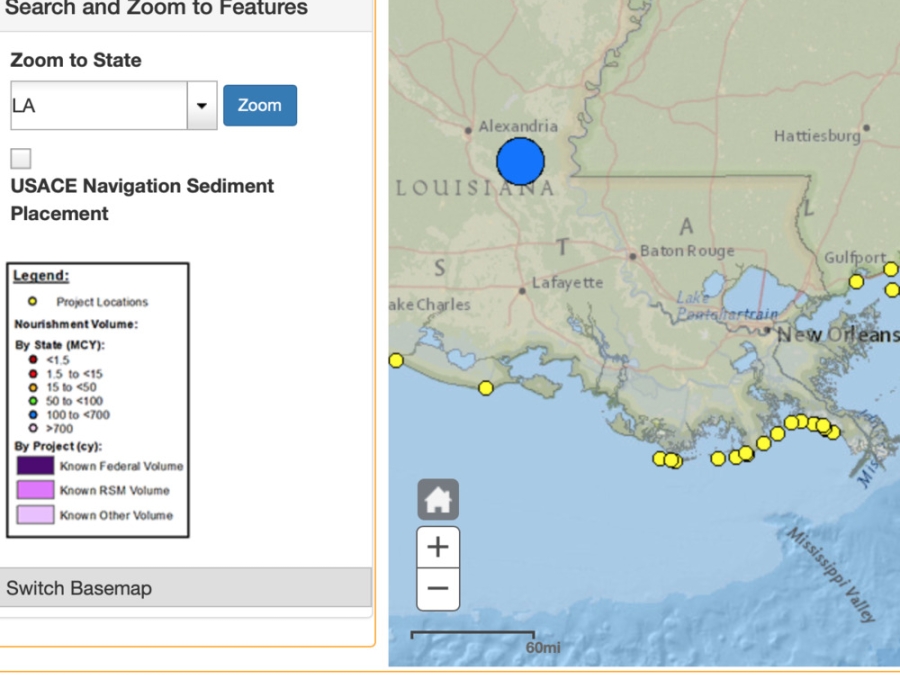
This resource provides data about beach nourishment projects throughout the United States.
National Levee Database
This database includes information about government levee projects across the United States. For each levee project, user have access to information such as the levee structure, the surrounding area, risk assessments, elevation profiles, and more.
Nepassist
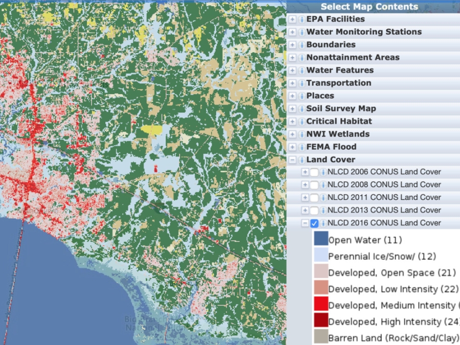
NEPAssist is a tool that facilitates the environmental review process and project planning in relation to environmental considerations. The web-based application draws environmental data dynamically from EPA Geographic Information System databases and web services and provides immediate screening of environmental assessment indicators for a user-defined area of interest. These features contribute to a streamlined review process that potentially raises important environmental issues at the earliest stages of project development.?
Neuston In The Great Pacific Garbage Patch And The Impact Of Cleanup
Plastic in our oceans has clear detriments to the ecosystems inhabiting them; nearly 700 marine species are reported to have encountered plastic debris, which can lead to entanglement, ingestion, or death. Protecting marine life from further harm caused by plastic pollution is the main driver behind our mission to rid the oceans of plastic. At the same time, we need to ensure that our cleanup operations have minimal negative side effects on marine ecosystems. This is why we not only closely monitor and study the interactions between our technology and the environment, but also invest in fundamental research to better understand the ecosystems we are determined to protect.
New Climate Maps Show A Transformed United States
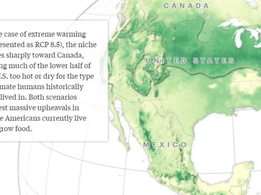
This article features interactive materials that allow the reader to investigate how climate change will impact individual counties throughout the United States. "Taken with other recent research showing that the most habitable climate in North America will shift northward and the incidence of large fires will increase across the country, this suggests that the climate crisis will profoundly interrupt the way we live and farm in the United States. See how the North American places where humans have lived for thousands of years will shift and what changes are in store for your county."
New Drinking Water Report: Communities Of Color More Likely To Suffer Drinking Water Violations For Years
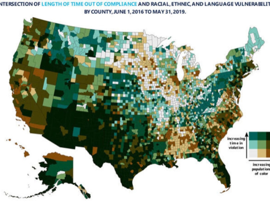
Race bears the strongest relationship to slow and ineffective enforcement of the federal drinking water law in communities across the nation, according to a new report released today. Watered Down Justiceis a new analysis of EPA data that confirms there is unequal access to safe drinking water, based most strongly on race, a scientific conclusion that mirrors the lived experience of people of color and low-income residents in the United States.
New Growth To The North
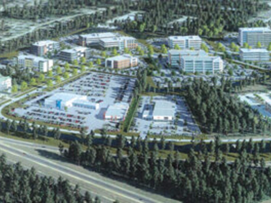
Today's Northshore millennials are spreading their wings to find new housing and livelihoods in newly developed parts of St. Tammany Parish. And it's not just homeowners, either: Regional companies are finding the Northshore to their liking as well. These two demographic factors - millennials and new companies - have helped sustain the economic engine of the latest and largest mixed-use developments of retail, residential and office hubs across the parish. To St. Tammany's economic leaders, the crystal ball is even more promising: This trend of positive growth is expected to continue for quite some time.
New Link In The Food Chain? Marine Plastic Polluion And Seafood Safety
In recent years plastic pollution in the ocean has become a significant environmental concern for governments, scientists, nongovernmental organizations, and members of the public worldwide. A December 2014 study derived from six years of research by the 5 Gyres Institute estimated that 5.25 trillion plastic particles weighing some 269,000 tons are floating on the surface of the sea. At the same time, plastics in consumer products have become subject to increasing scrutiny regarding their potential effects on human health.

