Filter These Results +
Critical Habitat, Coastal Land Loss, And Land Loss/ Land Change Analysis Of The Lake Pontchartrain Basin, Louisiana
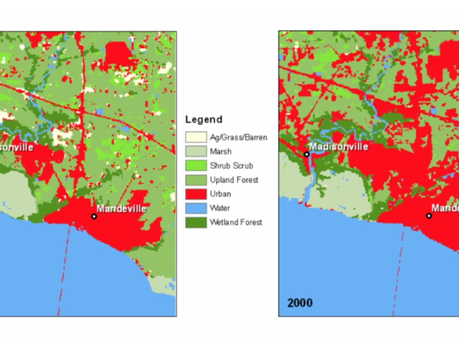
Wetlands in the Lake Pontchartrain Basin have declined dramatically since 1982 due to a variety of causes such as urbanization and coastal erosion. Although natural processes have contributed to some of this loss, much of it can be attributed to human activities. Some of the wetland losses can be directly traced to dredging or filling of these areas... The Florida Parishes, which include East Baton Rouge, East Feliciana, Livingston, St. Tammany, Tangipahoa, and Washington Parish, have experienced an accelerated population growth during the past 18 years. Residential/urban land use grew by over 105 percent between 1982 and 2000 with most of the development occurring in Livingston and St. Tammany Parishes.
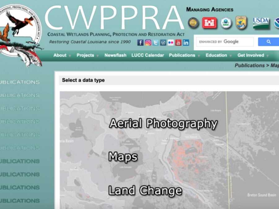
Cwppra Maps Portal
This site provides the user with downloadable aerial photography, maps, land change, and hurricane information for Louisiana.
Cwppra Maps Portal
This site provides the user with downloadable aerial photography, maps, land change, and hurricane information for Louisiana.
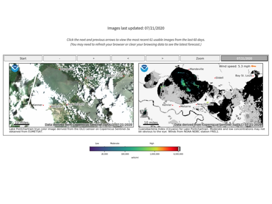
Cyanobacteria Assessment Network (Cyan)
CyAN is a multi-agency project among EPA, the National Aeronautics and Space Administration (NASA), the National Oceanic and Atmospheric Administration (NOAA), and the United States Geological Survey (USGS) to develop an early warning indicator system to detect algal blooms in U.S. freshwater systems. This research supports federal, state, tribal, and local partners in their monitoring efforts to assess water quality to protect aquatic and human health.
Deadline Set For Residents Of Vanishing Isle De Jean Charles To Apply For Relocation
Residents of a sinking Louisiana island have until the end of the month to apply for a new home under a first-of-its-kind federal program to help people retreat from the effects of climate change. The state Office of Community Development set Jan. 31 as the deadline for Isle de Jean Charles residents to request resettlement in a new housing development near Houma or an existing home elsewhere in Louisiana. The mostly Native American Isle de Jean Charles community in Terrebonne Parish has lost 98% of the land surrounding their homes since 1955, the result of a combination of subsidence, erosion and sea-level rise.
Debris Tracker Data
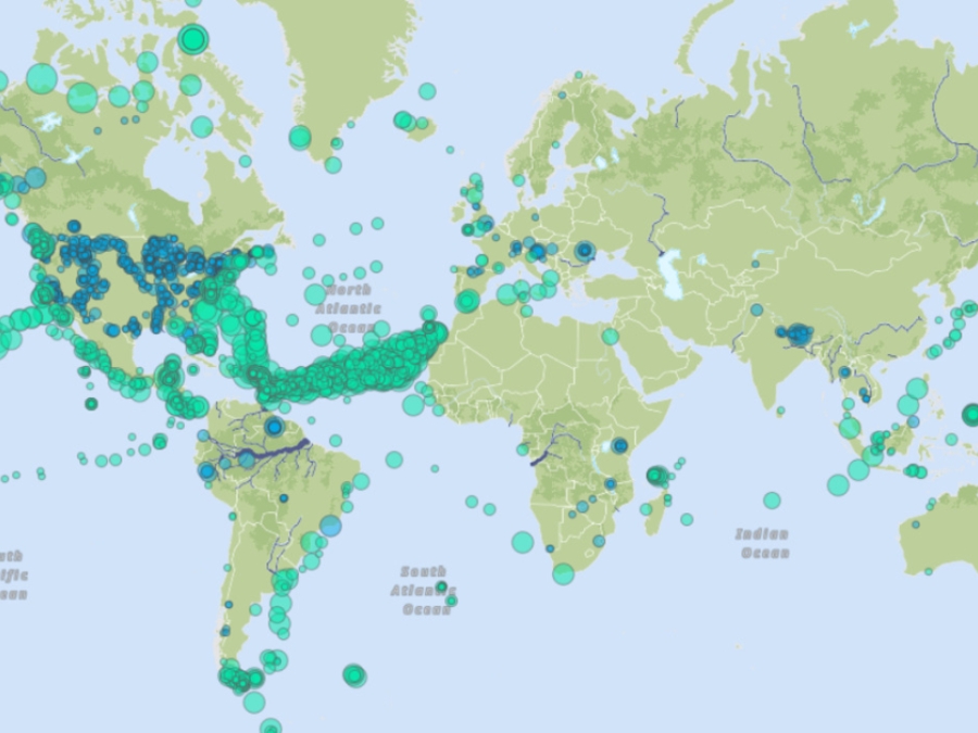
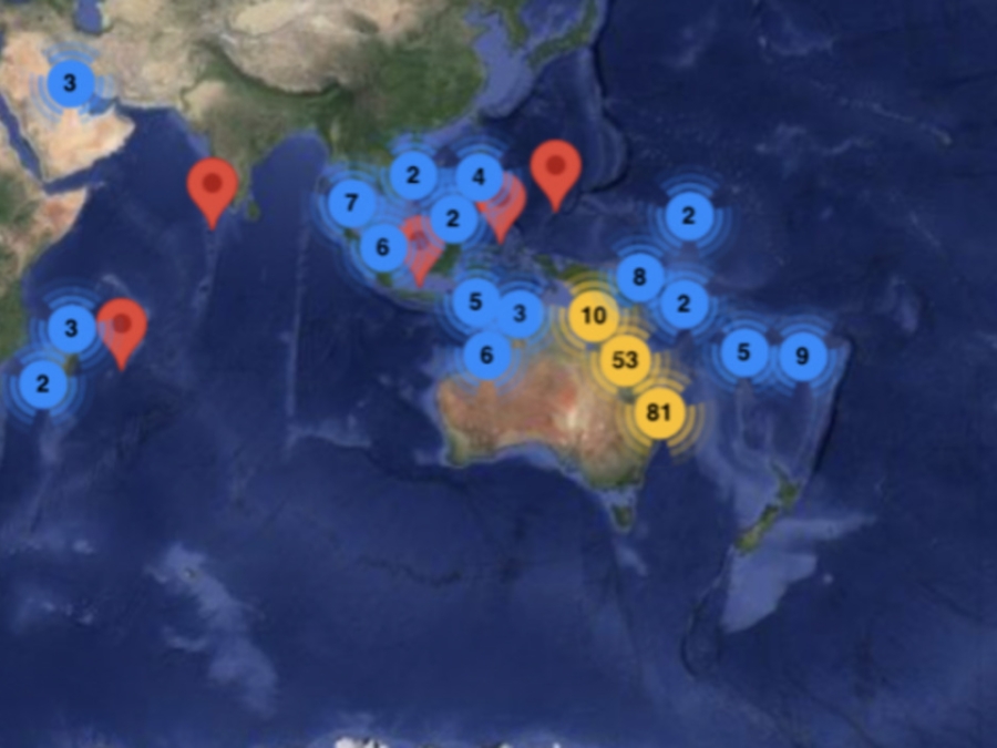
Debris Tracker is designed to help citizen scientists like you make a difference by contributing data on plastic pollution in your community. We've been tracking litter since before smartphones existed, and we're still driven by uniting technology and citizen science to fight plastic pollution. Every day, dedicated educational, non-profit, and scientific organizations and passionate citizen scientists from all around the world record data on inland and marine debris with our easy-to-use app, contributing to our open data platform and scientific research.
Deepwater Horizon
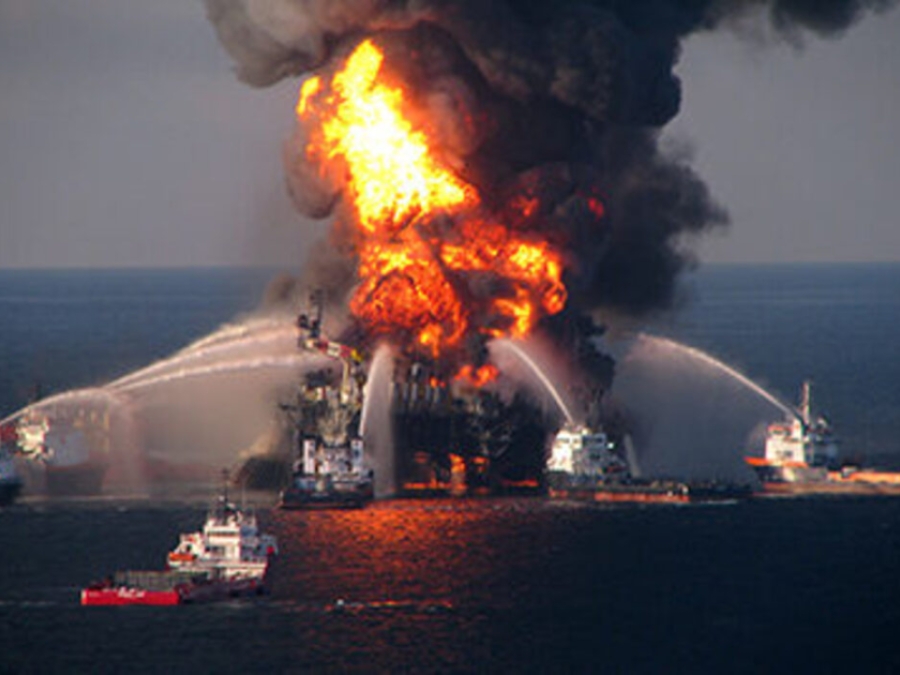
On April 20, 2010, an explosion occurred on the Deepwater Horizon drilling platform in the Gulf of Mexico. The explosion, which killed 11 men, caused the rig to sink and started a catastrophic oil leak from the well. Before it was capped three months later, approximately 134 million gallons of oil had spilled into the Gulf, the largest offshore oil spill in U.S. history. Through the Natural Resource Damage Assessment (NRDA), we evaluated the type and amount of restoration needed in order to return the Gulf to the condition it would have been in before the spill and to compensate the public for the natural resource services that were injured or lost. The Deepwater Horizon spill resulted in the largest natural resource damage assessment ever undertaken.
Delta Dispatches (Podcast)
On today's show, our hosts are joined by Darilyn Turner, Executive Director of Zion Travelers Cooperative Center, and four of her trainees to talk about her organization and what makes the East Bank the best bank. ZTCC is an organization that's built around advocating for coastal restoration, disaster preparedness and connecting the youth of Plaquemines Parish to the environment. In the second half the show, Chris Roberts, Grants Manager of Louisiana Endowment for the Humanities and Monica Barra, Research Assistant for The Water Institute of the Gulf, talk about the documentary series Water/Ways.
Designing Future Coastal Communities
In this episode, we're at the University of Hawai'i at M?noa's School of Architecture. We're looking at projects designed to help coastal O'ahu communities adapt to climate change and sea level rise. We talk to students, researchers and faculty about their focus on sustainability and community resilience.
Diy Lake Science
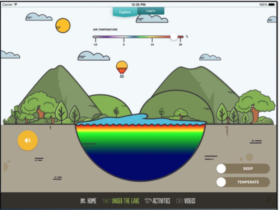
DIY Lake Science allows families and educators to investigate and learn about lakes and other freshwater ecosystems at home, at school, or anywhere you go! The app includes a dozen easy to use, hands-on activities to learn about freshwater ecosystems. Each activity includes step-by-step instructions that have been tested by educators, kids, and families. The activity materials are widely available and inexpensive - you probably have many of them in your home.
Dolphins Are Dying At An Alarming Rate
Scientists are puzzled by a disturbing trend in the waters along four Gulf Coast states. Almost 300 dead and dying dolphins have washed ashore since February, three times the usual number. Mark Strassman reports.
Dutch Coastal Maintence With Sand
This video shows how Rijkswaterstaat uses sand to keep the Dutch coast safely in its place. In this way the Netherlands is protected against the sea.
Economic Benefits Of Wetlands
Wetlands contribute to the national and local economies by producing resources, enabling recreational activities and providing other benefits, such as pollution control and flood protection. While it can be difficult to calculate the economic value provided by a single wetland, it is possible to evaluate the range of services provided by all wetlands and assign a dollar value. These amounts can be impressive. According to one assessment of natural ecosystems, the dollar value of wetlands worldwide was estimated to be $14.9 trillion. (Source: Costanza et al. 1997) This fact sheet summarizes some of the important ways in which wetlands contribute to the economy.
Effects Of Urbanization On Ecosystems
Development can have negative effects on streams in urban and suburban areas. As a watershed becomes covered with pavement, sidewalks, and other types of urban land cover, stream organisms are confronted with an increased volume of storm water runoff, increased exposure to fertilizers and pesticides, and dramatic changes in physical living spaces within the stream itself.
Engineering Tsunami Resilience
In this episode of Voice of the Sea, we investigate how engineers study and design buildings to withstand destructive forces, like tsunamis. We'll learn about the dangers to Hawai'i, the plan for vertical evacuation in Honolulu, and the new building code.
Enviroatlas
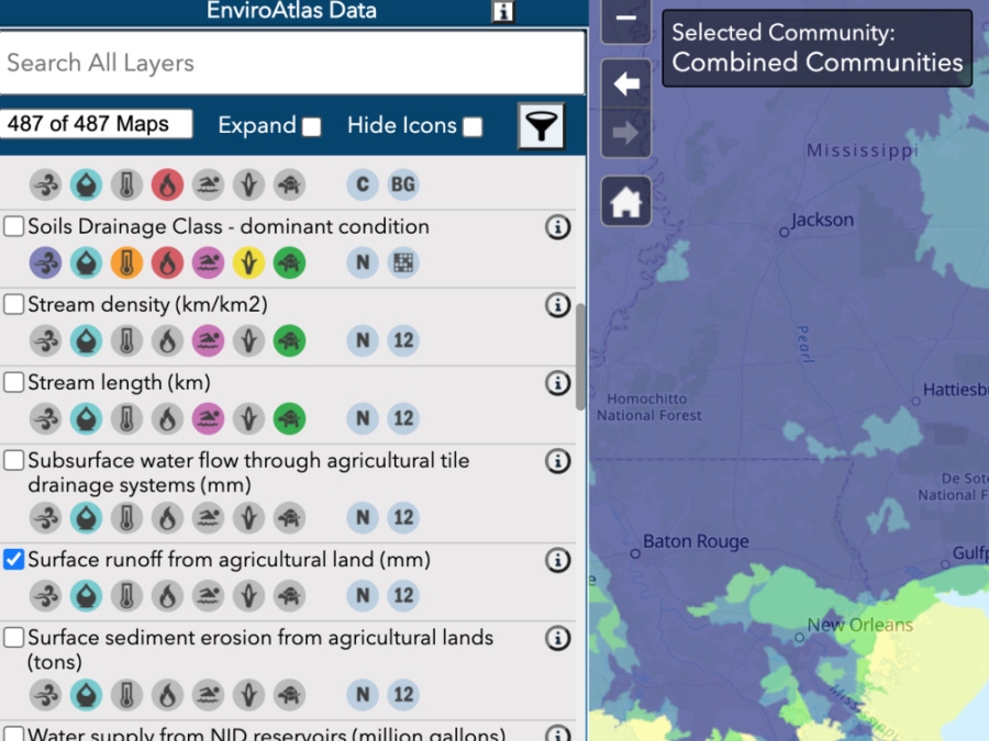
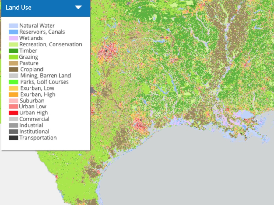
The EnviroAtlas Interactive Map is a discovery and analysis tool for hundreds of data layers relating to ecosystem services, biodiversity, people, and the built environment.
Enviroatlas
The EnviroAtlas Interactive Map is a discovery and analysis tool for hundreds of data layers relating to ecosystem services, biodiversity, people, and the built environment.
Environmental Performance Of Wetlands Receiving Nps Nutrient Loads
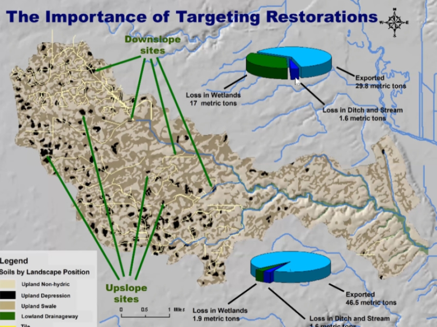
The research presented in this webinar is one of the largest and longest running projects of its kind and helps to clarify the potential benefits and limitations of targeted wetland restorations. The research methods are also being used to monitor the impact of in-field practice changes through the Conservation Learning Lab project.
Estuarine Submerged Aquatic Vegetation Habitat Provides Organic Carbon Storage Across A Shiftign Landscape
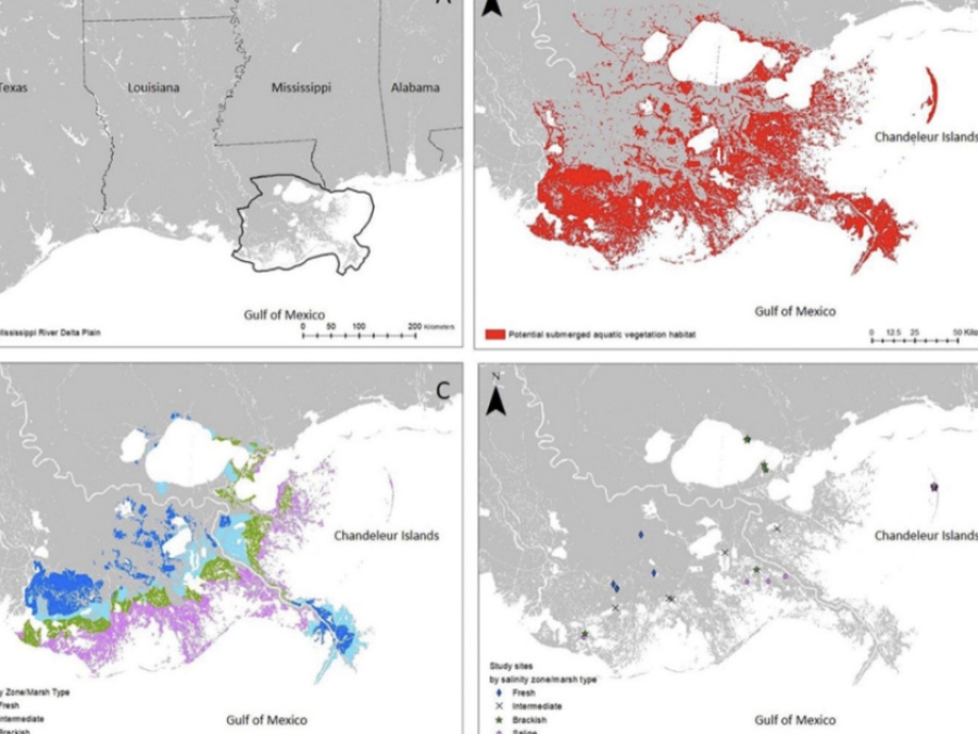
Submerged aquatic vegetation (SAV) thrives across the estuarine salinity gradient providing valuable ecosystem services. Within the saline portion of estuaries, seagrass areas are frequently cited as hotspots for their role in capturing and retaining organic carbon (Corg). Non-seagrass SAV, located in the fresh to brackish estuarine areas, may also retain significant soil Corg, yet their role remains unquantified. Given rapidly occurring landscape and salinity changes due to human and natural disturbances, landscape level carbon pool estimates from estuarine SAV habitat blue carbon estimates are needed.
Estuary Data Mapper
This tool "includes information about coastal rivers, tributaries, and watersheds. It gives users the ability to display background information, such as cities and roads, to help them explore areas of interest and learn more about the context. This data can help researchers gauge the status of estuary environments and possible threats - facilitating the use of decision-support tools to help them visualize the effects of potential management actions. For example, having access to nitrogen loading sources and predictive models of seagrass habitat can help communities and watershed organizations research ways to reduce nitrogen loads."
Estuary Education
Estuaries are invaluable resources for coastal dwellers, whether of fin, fur, or feather. For people, these ecosystems offer protection, recreation, and a wealth of learning opportunities. On this site, educators and estuary enthusiasts will find a variety of resources, including specially developed activities, animations, videos, teacher training workshops, real-time data, and opportunities to volunteer at a local reserve. This information will help educators share the wonders of estuaries with students and others.
Estuary Education Resources
Why teach about estuaries? This suite of estuary education resources help educators bring estuarine science into the classroom through hands-on learning, experiments, fieldwork, and data explorations. These specially designed lessons, activities, data explorations, animations and videos can be used independently or as a supplement to existing curricula and can be adapted to meet any grade level.
Explore More: Water Quality
The water we drink, the places we swim, and the plants and animals within our environment are increasingly threatened by one thing--pollution. Agricultural practices, household uses, urban runoff, and other sources significantly impact our communities and the world. The ways we use water, the pollutants found in it, and the issues that challenge its quality must be understood if we are to protect this vital resource. This award-winning program examines the threats, surveys the experts, and challenges you to make a difference through the choices you make.
Fecal Coliform Bacteria In Water
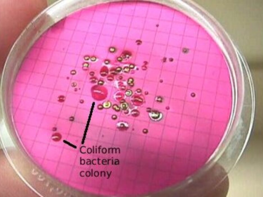
Total coliform bacteria are a collection of relatively harmless microorganisms that live in large numbers in the intestines of man and warm- and cold-blooded animals. They aid in the digestion of food. A specific subgroup of this collection is the fecal coliform bacteria, the most common member being Escherichia coli. These organisms may be separated from the total coliform group by their ability to grow at elevated temperatures and are associated only with the fecal material of warm-blooded animals.
Fema Buyout Not As Easy As It Sounds
There is a flurry of talk about large-scale home buyouts as one answer to reducing flood risk, but the reality is any massive buyout plan is much easier said than done." In this news segment from KHOU 11, Houston residents and homeowners offer their perspectives on the plan to buy and repurpose land in areas more likely to experience flooding
Finding Common Ground
Louisiana's struggle to restore Louisiana's Mississippi River Delta has resulted in a new Master Plan that embraces new advances in scientific knowledge - new tools for rebuilding the coast. Local, traditional ecological knowledge can also be a tool for cost saving planning. Finding Common Ground uses documentary film techniques to show how all those impacted by coastal erosion can cross over out of their silos, overcome long term psychological barriers, and achieve new understanding that may fast track restoration projects to build much needed new ground.
Fish Communinties In Submerged Aquatic Vegetation
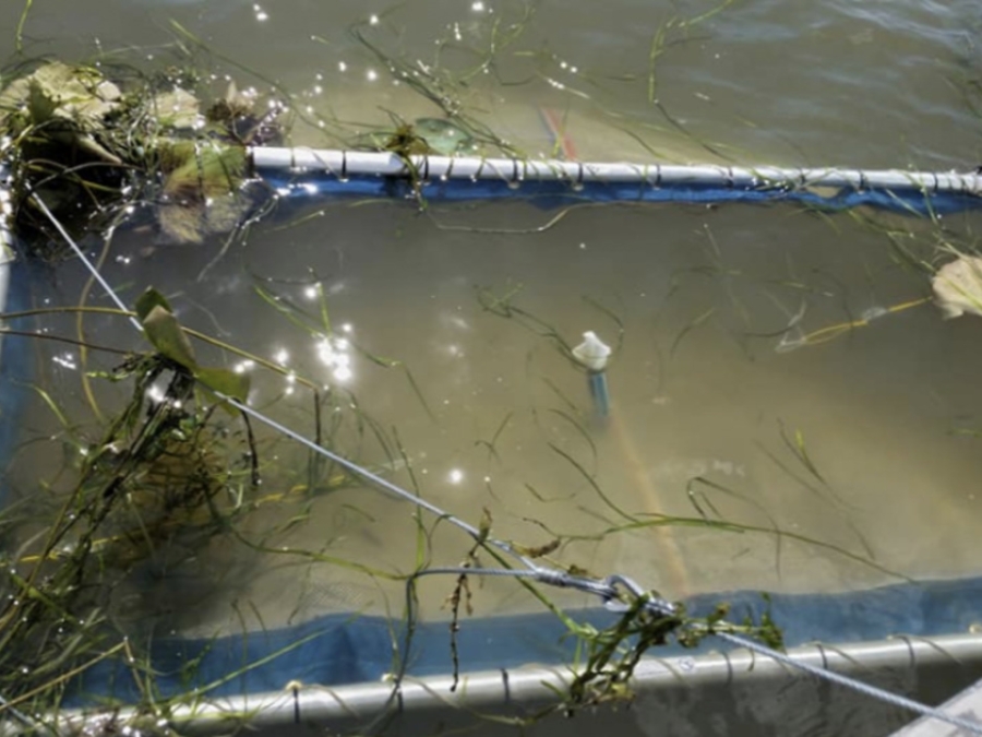
Submerged aquatic vegetation (SAV) are underwater plants that grow in shallow water and do not emerge above the surface. These areas are important nurseries for juvenile fish and provide refuge for smaller species of fish and invertebrates from predators.
Flint's Water Crisis, Exlained
Flint, Michigan, tried to save money on water. Now its children have lead poisoning. Joe Posner explains.
Fossil Atmospheres
We want to create a record of how the atmosphere has changed through time by calculating the ratio of two different types of leaf cell (stomatal and epidermal) for many leaves, from the present and the geological past. We know that the composition of the Earth's atmosphere has changed over time, and that it is changing now. It is important for us to understand what effect climate change might have on life on our planet in the long term.
Fundamentals Of Remote Sensing
Participants will become familiar with satellite orbits, types, resolutions, sensors and processing levels. In addition to a conceptual understanding of remote sensing, attendees will also be able to articulate its advantages and disadvantages. Participants will also have a basic understanding of NASA satellites, sensors, data, tools, portals and applications to environmental monitoring and management.
Game Of Floods
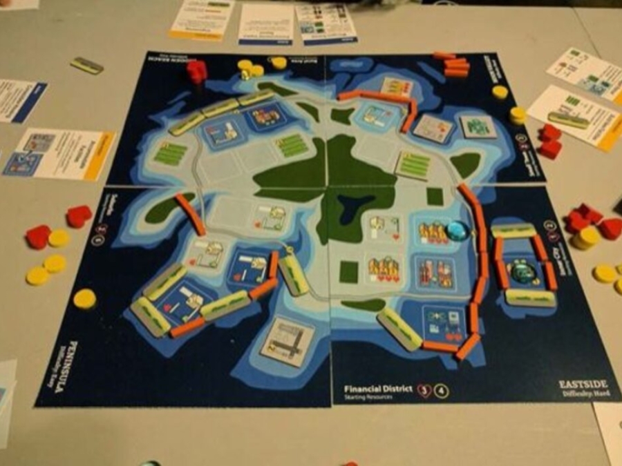
Sea levels are rising world-wide as warming oceans expand and melt glaciers and ice sheets. Stronger storms coupled with rising seas can significantly damage - even destroy - property, infrastructure, public facilities, natural habitats, and other resources we depend on. In the face of these threats, planning commission members are tasked with collaboratively developing an Adaptation Plan using the strategies (game pieces) for the scenarios provided.
Gecoserv
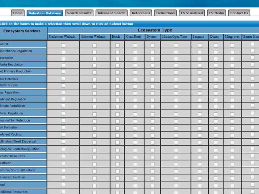
This online database provides a searchable inventory of valuation studies for ecosystem services that focus on an identified ecosystem and provide monetary value for these services. Ecosystem valuation data are abundant, yet they are often hard to find. GecoServ functions as a centralized source and user-friendly interface for the information. It promotes the distribution and sharing of these valuation studies, provides researchers with background information for future studies, and helps resource managers include ecosystem services in the decision-making process.
Global Change Explorer
The Integrated Climate and Land Use Scenarios (ICLUS) outputs are derived from a pair of models. A demographic model generates population projections for all counties of the conterminous United States to the year 2100. Those projections drive a spatial allocation model that distributes new housing units across the landscape in response to population growth.
Global Ice Viewer
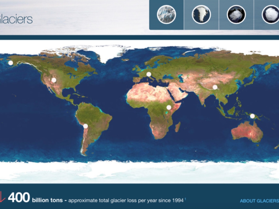
Explore the sentinels of climate change with this interactive global ice viewer." Includes interactive viewers for glaciers worldwide, Greenland and Iceland, the Arctic, and Antarctica
Global Microplastic Intiative
After four years of collecting water samples, we are confident that our dataset represents the most diverse and one of the largest datasets exposing the extent of microplastic pollution around the globe. With this in hand, we have transitioned to data analysis as we seek a deeper understanding of microplastic pollution, and importantly, how our work can contribute to positive change. This data has already inspired businesses to reduce their plastic consumption, is being used by governments towards conservation decision making, and has motivated over 80% of our project volunteers into taking action towards reducing plastic pollution.
Global Report On Internal Displacement
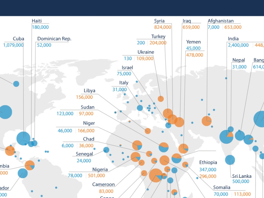
The Global Report on Internal Displacement presents the latest information on internal displacement worldwide caused by conflict, violence and disasters.
Goodbee Subdivision Reduced In Size, Remaining Portion To Be Left As Wetlands
Residents of the Goodbee area northwest of Covington who have been fighting the development of new subdivisions in the flood-prone area for years got some good news at the St. Tammany Parish Zoning Commission's Feb. 4 meeting. Commissioners approved a request to reduce the size of the planned unit development formerly known as The Preserve at Goodbee Lakes from 75 to 32 acres and rezone the remaining 43 acres to A-1 Suburban District so they could be maintained as wetlands. The number of homesites would be reduced from 92 to 66.
Google Earth
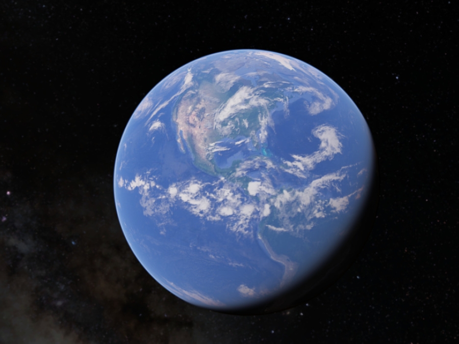
Google Earth is a computer program that renders a 3D representation of Earth based primarily on satellite imagery.
Google Earth
Google Earth is a computer program that renders a 3D representation of Earth based primarily on satellite imagery.
Goose Point/Point Platte Marsh Creation (Po-33)
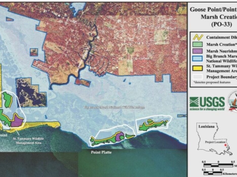
The goal of this project is to re-create marsh habitat in the open water behind the shoreline. This new marsh will maintain the lake-rim function along this section of the north shore of Lake Pontchartrain by preventing the formation of breaches into interior ponds. Sediment will be dredged from Lake Pontchartrain and contained in cells within the interior ponds to create approximately 417 acres of marsh. In addition, 149 acres of degraded marsh will be nourished with dredged material. Marsh will be created to widen the shoreline so that the ponds will not be breached during the course of normal shoreline retreat.
Grand Isle Sea Level (1870-2013)
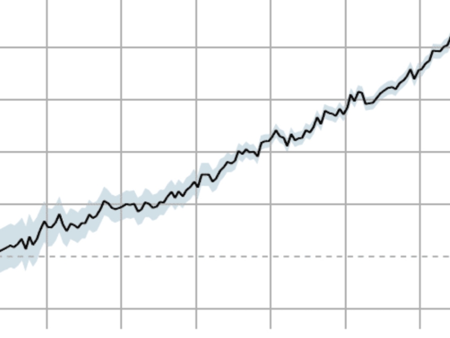
This graph utilizes sea level gauge records to provide data on sea level change from 1870-2013.
Grand Isle Sea Level (1947-2019)
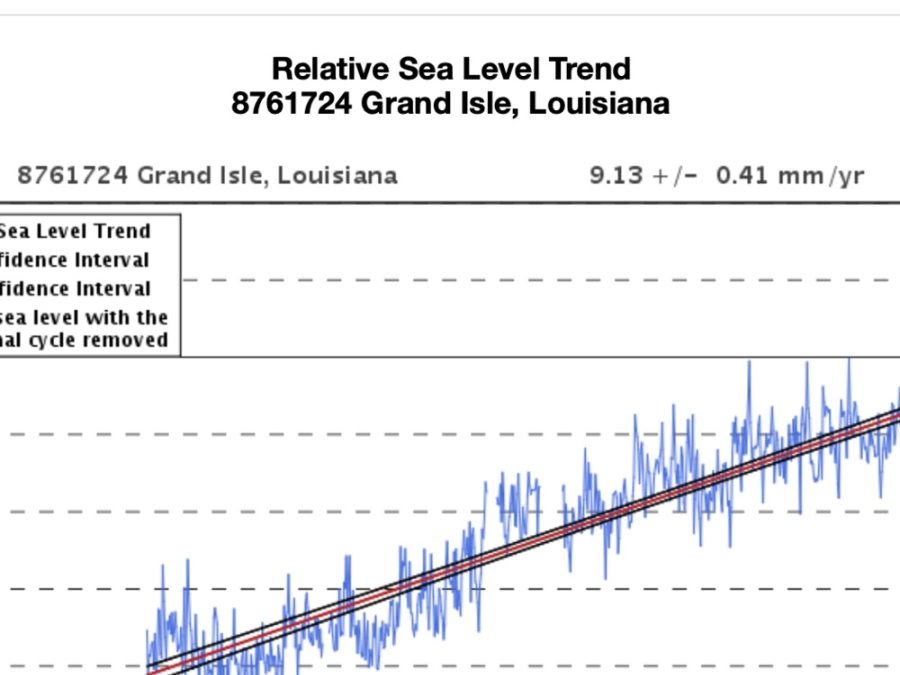
The plot shows the monthly mean sea level without the regular seasonal fluctuations due to coastal ocean temperatures, salinities, winds, atmospheric pressures, and ocean currents. The long-term linear trend is also shown, including its 95% confidence interval.
Great Pacific Garbage Patch
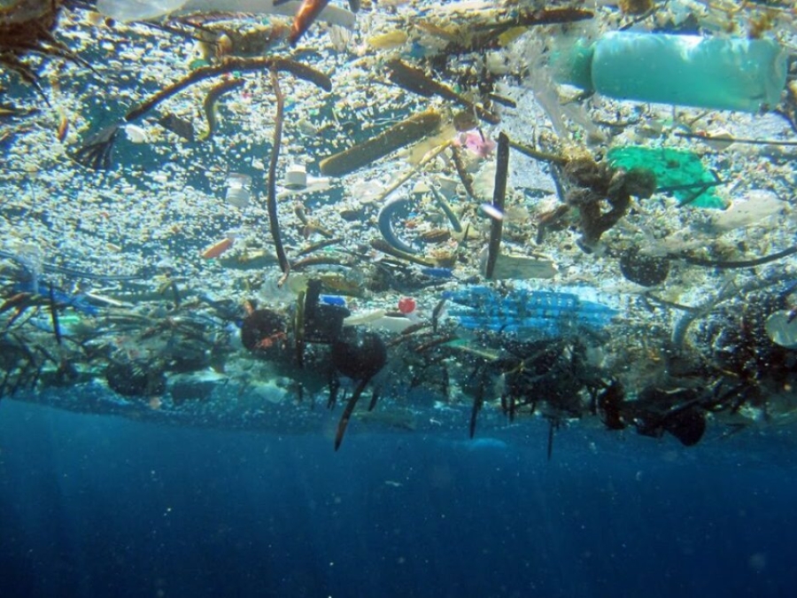
The Great Pacific Garbage Patch is a collection of marine debris in the North Pacific Ocean. Marine debris is litter that ends up in oceans, seas, and other large bodies of water. The Great Pacific Garbage Patch, also known as the Pacific trash vortex, spans waters from the West Coast of North America to Japan. The patch is actually comprised of the Western Garbage Patch, located near Japan, and the Eastern Garbage Patch, located between the U.S. states of Hawaii and California.
Guide To Effective Outreach In Your Watershed
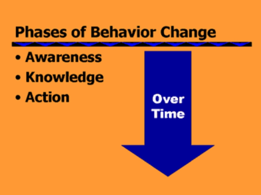
[Nonpoint source pollution] is generated by all of us, a product of millions of actions that we take each day, including activities such as applying pesticides, washing our cars, or walking our pets. However, by becoming more aware of the effect of our actions on our rivers, streams, lakes, bays and seashores, we can all develop more water-friendly habits and practices that will enable us to protect and restore the quality of these waters.
Gulf Of Mexico Data Atlas
Seagrass ecosystems are among the most productive and valuable benthic habitats found in the in the waters of the Gulf of Mexico region. They support a diverse array of ecological and habitat functions, as well as various human activities along the Gulf Coast. Maintaining and improving the health of seagrass ecosystems and all coastal and marine ecosystems are essential for ensuring the ecological and economic health of the Gulf of Mexico region.
Habitat Restoration Isn'T Just For Professionals
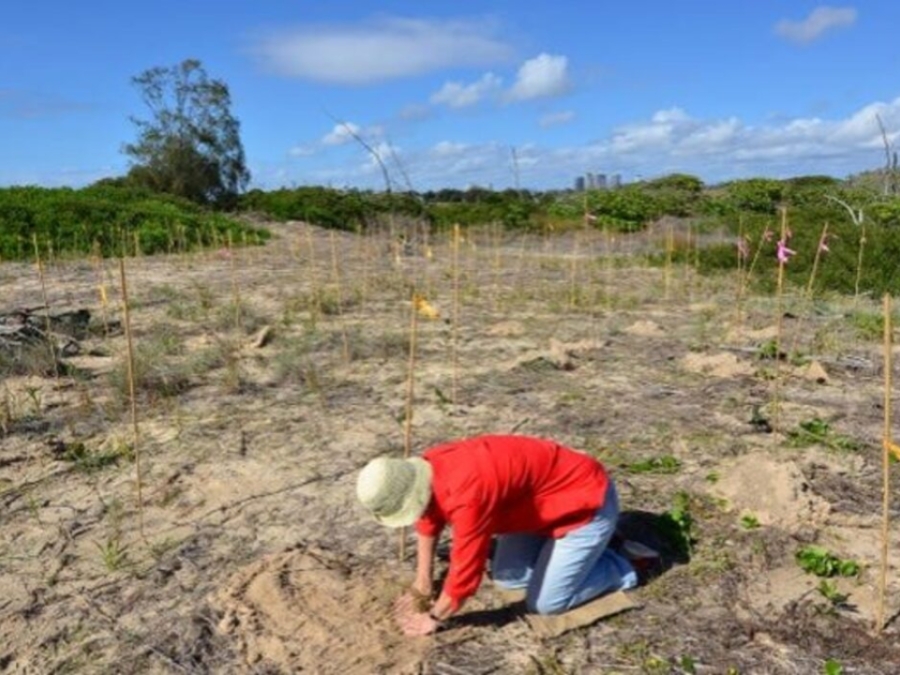
Community-based restoration is, essentially, a sustainable conservation program. Rather than relying on present-day law and public opinion to assign importance, it incorporates the value of conservation efforts into the backbone of a community. When executed correctly, habitat restoration becomes a critical consideration of the legal, academic and economic infrastructures in a given location. Let's take a look at what community involvement in each of these areas might look like.
Harmful Algal Bloom Monitoring
Harmful algal blooms (HABs), sometimes known as "red tide", occur when certain kinds of algae grow very quickly, forming patches, or "blooms", in the water. These blooms can emit powerful toxins which endanger human and animal health. Reported in every coastal state, HABs have caused an estimated $1 billion in losses over the last several decades to coastal economies that rely on recreation, tourism, and seafood harvesting. Blooms can lead to odors that require more costly treatment for public water supplies. NCCOS conducts and funds research that helps communities protect the public and combat blooms in cost-effective ways, and we are breaking new ground in the science of stopping blooms before they occur.
