How Hurricans Shape Wetlands In Southern Louisiana

While hurricanes aren't likely to entirely remove the wetlands, they are able to do significant damage. Their powerful winds, rainfall and rushing floodwater can do enough harm to permanently remove land. The pounding surf can break down marshes' soft sediments and thick mats of dead grass, which are pliable and easily reshaped. Sometimes channels of fast-moving water flow to inland areas, which never again dry up - contributing to permanent land loss.
How Levee Wars Make Floods Worse

In our latest Vox + ProPublica collaboration, we dive into how a structure that's designed to protect us from floods, may actually be making them worse. High levees come at a high cost, often pushing water into communities that can't afford the same protection. To demonstrate, we built a giant, scientific model of a river with levees - complete with adorable tiny houses.

How Native American Communities Are Addressing Climate Change

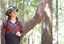
Indigenous peoples are one of the most vulnerable communities when it comes to the effects of climate change. This is due to a mix of cultural, economic, policy and historical factors. Some Native American tribal governments and councils have put together their own climate risk assessment plans. Native American communities are very diverse - and the challenges and adaptations are just as varied.

How To Cleanse You Beauty Regime

Every year five million to 14 million tons of plastic flow into the oceans from coastal areas. And every time you brush your teeth, wash your face, or take a shower, you could be sending more microplastics down the drain." This video offers some ways that consumers can limit their use of microplastics by making informed and responsible purchases

How's My Waterway

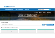
How's My Waterway? was designed to provide the general public with information about the condition of their local waters based on data that states, federal, tribal, local agencies and others have provided to EPA. Water quality information is displayed on 3 scales in How's My Waterway; community, state and national. More recent or more detailed water information may exist that is not yet available through EPA databases or other sources.

How's My Waterway?

How's My Waterway? was designed to provide the general public with information about the condition of their local waters based on data that states, federal, tribal, local agencies and others have provided to EPA. Water quality information is displayed on 3 scales in How's My Waterway; community, state and national. More recent or more detailed water information may exist that is not yet available through EPA databases or other sources.

How-To Guide For Environmental Refugees

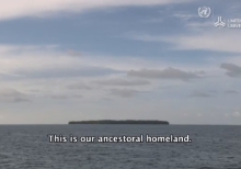
Carterets' people are facing, and will continue to face, many challenges as we relocate from our ancestral grounds. However, our plan is one in which we remain as independent and self-sufficient as possible. We wish to maintain our cultural identity and live sustainably wherever we are. While we call on the Papua New Guinea government to develop policy, we are not sitting by. Instead, we now want to see the media headlines translate into practical assistance for our relocation program.

Hurricanes And Rising Seas: Coastal Flooding In An Uncertain Future

With rising sea levels, coastal environments and communities are increasingly vulnerable to flooding from strong storms, including hurricanes. Join Teresa Crean from RI Sea Grant and URI's Coastal Resources Center and host Holly Morin of the Inner Space Center for a live discussion about climate change, coastal storms and the tools to help us prepare for flooding in an uncertain future.