Using Sediment Enhancing To Build Tidal Marsh Resiliency On Blackwater National Wildlife Refuge

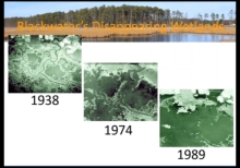
"Located in Maryland, USA, Blackwater National Wildlife Refuge is part of the largest area of tidal marsh within the Chesapeake Bay watershed, and is of regional ecological significance for its wetlands and for the wildlife populations it supports. However, over 5,000 acres of tidal marsh have converted to open water on the refuge since 1938... In December 2016, 26,000 cubic yards of sediment was pumped in a thin-layer application over approximately 40 acres of tidal marsh on the refuge. The purpose of this project is to raise the elevation of the existing marsh platform."
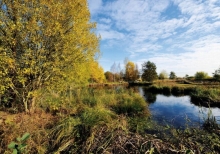
Using Sediment Enhancement To Build Tidal Marsh Resiliency

Located in Maryland, USA, Blackwater National Wildlife Refuge is part of the largest area of tidal marsh within the Chesapeake Bay watershed, and is of regional ecological significance for its wetlands and for the wildlife populations it supports. However, over 5,000 acres of tidal marsh have converted to open water on the refuge since 1938... In December 2016, 26,000 cubic yards of sediment was pumped in a thin-layer application over approximately 40 acres of tidal marsh on the refuge.

Urban Wetlands

Recently the possibilities for creating wetlands in and around towns and cities have been given more attention, following the disappearance in recent decades of large stretches of wet nature, and thus also natural buffers, as a result of urban expansions and land drainage. Wetlands are created to buffer some of the run-off from precipitation and slow the rate at which it drains away. This is a new approach compared with rapid drainage systems using ditches and pipes.

Understanding Sea Level

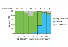
Scientists know that sea level is rising, and that we experience some of these impacts as more frequent and intense storm surge and coastal flooding events. Using data from NOAA's satellites and coastal stations, you will do the analysis to see sea level changing.

Understanding Salinity

Changes in landuse, seasonal variations in our weather and longer-term changes to climate can all affect surface water, groundwater, the flows between them, and the amounts of salt that they contain. The term "salinity" refers to the concentrations of salts in water or soils. Salinity can take three forms, classified by their causes: primary salinity (also called natural salinity); secondary salinity (also called dryland salinity), and tertiary salinity (also called irrigation salinity).

U.S. Epa: Polluted Runoff

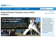
Nonpoint source (NPS) pollution is caused when rainfall or snowmelt, moving over and through the ground, picks up and carries natural and human-made pollutants, depositing them into lakes, rivers, wetlands, coastal waters and ground waters. Learn the basics of NPS pollution.

Types Of Pollutants That Affect Water Quality

Almost anyone or anything is a potential source of pollutants. So water quality experts group sources into two main categories of pollutants point sources and non-point sources. Homes, industries, wildlife, recreation, and transportation all depend on clean sources of water. Everyone uses it, needs it, and many of us take it for granted. These videos examine the ways water is used, profiles types of pollution, and presents a variety of perspectives on the issue of water quality. What are the biggest threats to water quality in your area?