Global Long-Term Observation Of Coastal Erosion And Accretion

Changes in coastal morphology have broad consequences for the sustainability of coastal communities, structures and ecosystems. Although coasts are monitored locally in many places, understanding long-term changes at a global scale remains a challenge. Here we present a global and consistent evaluation of coastal morphodynamics over 32 years (1984-2015) based on satellite observations.

Florida Seagrasses

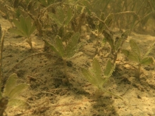
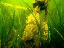
Seagrasses are grass-like flowering plants that live completely submerged in marine and estuarine waters. Although seagrasses occur throughout the coastal areas of Florida, they are most abundant in Florida Bay and from Tarpon Springs northward to Apalachee Bay in the Gulf of Mexico, which are two of the most extensive seagrass beds in continental North America.

Establishing A Baseline Of Estruarine Submerged Aquatic Vegetation Resources Across Salinity Zones Within Coastal Areas Of The Northern Gulf Of Mexico

Coastal ecosystems are dynamic and productive areas that are vulnerable to effects of global climate change. Despite their potentially limited spatial extent, submerged aquatic vegetation (SAV) beds function in coastal ecosystems as foundation species, and perform important ecological services. However, limited understanding of the factors controlling SAV distribution and abundance across multiple salinity zones (fresh, intermediate, brackish, and saline) in the northern Gulf of Mexico restricts the ability of models to accurately predict resource availability

Epa Illegally Lowered Allowed Oxygen Content Of North Shore Rivers: Suit

Before EPA approved a decision by the Louisiana Department of Environmental Quality to reduce the required dissolved oxygen level of the stream segments to 2.3 milligrams per liter from March through November, all of the affected waters were supposed to have oxygen levels no lower than 5 milligrams per liter for freshwater segments and no lower than 4 milligrams per liter for estuarine rivers and streams year-round in areas where freshwater and saltwater systems mix.

Drawing Louisiana's New Map: Addressing Land Loss In Coastal Louisiana

During the past 50 years, coastal Louisiana has suffered catastrophic land loss due to both natural and human causes. This loss has increased storm vulnerability and amplified risks to lives, property, and economies--a fact underscored by Hurricanes Katrina and Rita. Drawing Louisiana's New Map reviews a restoration plan proposed by the U.S.

Does Vegetation Prevent Wave Erosion Of Salt Marsh Edges?

Changes in coastal morphology have broad consequences for the sustainability of coastal communities, structures and ecosystems. Although coasts are monitored locally in many places, understanding long-term changes at a global scale remains a challenge. Here we present a global and consistent evaluation of coastal morphodynamics over 32 years (1984-2015) based on satellite observations.