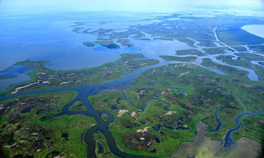
Bohemia Spillway
The Bohemia Spillway is located in Plaquemines Parish on the east bank of the Mississippi River about 35 miles southeast of New Orleans, LA. In the 1920’s Mississippi River stages at New Orleans were becoming higher and more threatening, and so the Bohemia Spillway was authorized in 1924 by the Louisiana State legislature for the purpose of creating a river flood relief outlet and reducing flood risk to New Orleans. Since 1926, the natural levee of the Bohemia Spillway has been periodically overtopped during flood events on the Mississippi River.
Learn More
Why Study the Bohemia Spillway?
Studying the Bohemia Spillway offers an opportunity to observe natural processes at work. While current conditions of the river and the receiving basin have changed over time, the Bohemia Spillway still offers a glimpse into the past of the way the river may have operated before human intervention. It also offers a glimpse at the historical interaction between the river and the wetlands before the river levees were built. The spillway also allows us to see the effects of overbank flow on wetlands, which could inform future operation of river diversions.

PC Research Program
PC has been investigating the spillway since 2007. Primarily we have studied periodic flooding, land loss and land gain, land elevation changes, and vegetation surveys. We also conducted extensive research during the 2011 Mississippi River flood.
Results
During the 2011 Mississippi River flood survey we saw that overtopping waters were captured quickly by small natural channels and gullies shortly after the water overtopped the natural levee. Little overland flow was observed, relegated to the forest found along the natural levee and not reaching the adjacent marshes.
Our land loss analysis from 1932 to 2010 showed that there have been low land loss rates in the spillway since 1975. The Bohemia Spillway does not seem to suffer the same interior land loss as other parts of the coast. This stability may be the result of periodic pulses of water and sediment received from the Mississippi River during flood events but could also be due to underlying geology, or a combination of the two.
Canals in the Bohemia Spillway are being reclaimed by infilling. This is a rare occurrence in southeast Louisiana where canals usually expand and contribute to interior marsh loss. Through our observations and study, we have concluded that the pulsed flow from the Mississippi River in flood years since 1926 has contributed to the sustainability and resiliency of marshes in the Bohemia Spillway.